March 24, 2025
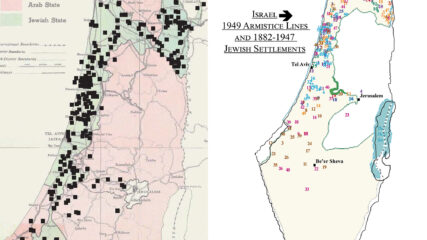
By Ken Stein and Scott Abramson, March 23, 2025 Zionist/Jewish Economic Development in Palestine Before 1948 Jewish physical growth in Mandatory Palestine in the period known as the New Yishuv was sufficient through land acquired...
June 13, 2021
Update June 9, 2026; originally posted June 2021. Compiled by Dr. Ken Stein, CIE President, June 9, 2026 These sources and references unfold the history of the Jewish state through 1949, from state-seeking to state-making...
July 5, 2023
From 1898 to 1948, Zionism evolved from an idea to a concrete reality: the actual establishment of the Jewish state, Israel. Slowly, a few immigrating Jews created facts by linking people to the land. For half a century, fortuity and fortitude made the Zionist undertaking a reality. They exhibited pragmatism and gradually constructed a nucleus for a state. Through perseverance Zionists empowered themselves.
August 21, 1933
A report presented at the 18th Zionist Congress looks at the present and future of Jewish agricultural settlement and expansion in Mandatory Palestine, including the export market.
November 2, 1917
The British Foreign Ministry promises to work toward a Jewish national home in Palestine with no harm to non-Jewish populations or to Jews living elsewhere who might want to support a Jewish home.
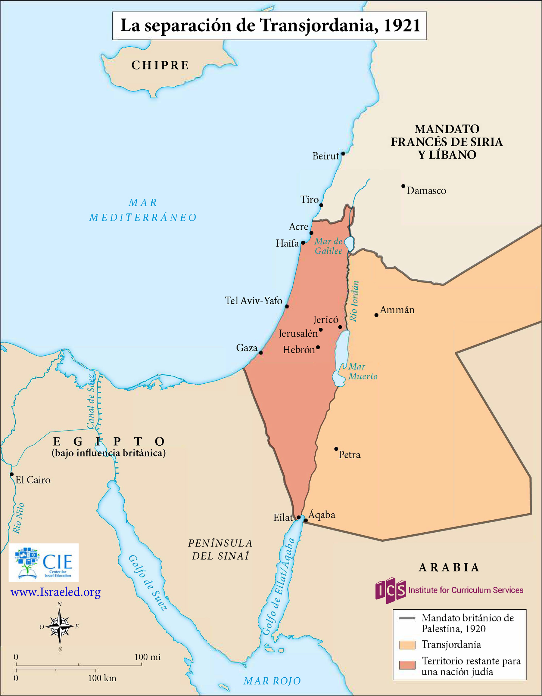
April 25, 1920
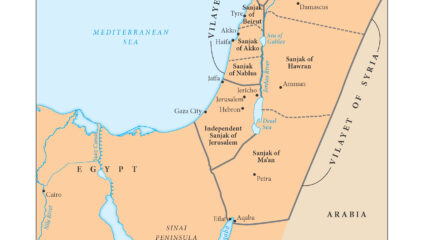
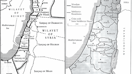
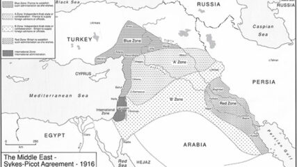
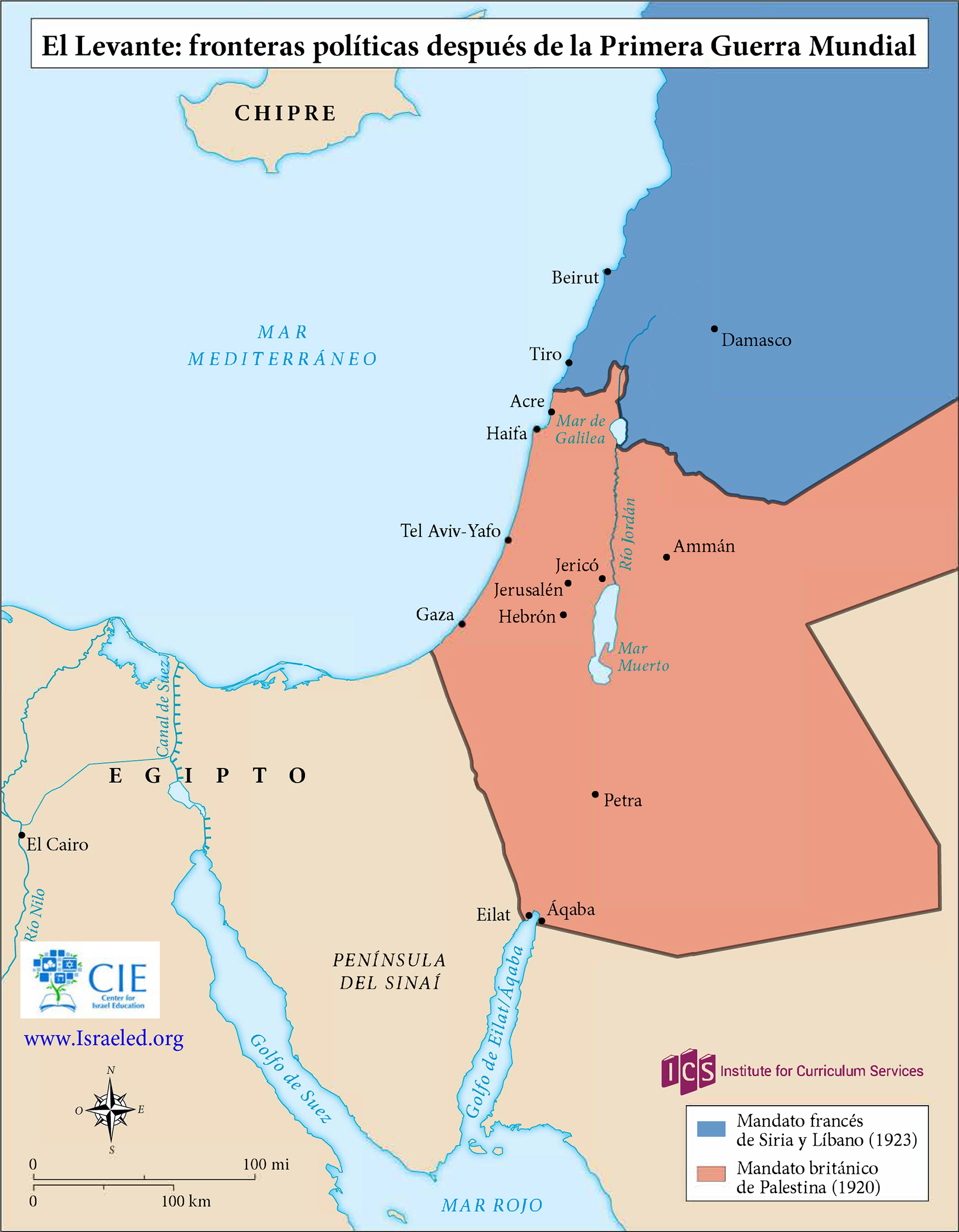
The post-WWI San Remo Conference allocates former Ottoman territories to Britain and France and recognizes Jewish self-determination in Palestine by adopting the language of the Balfour Declaration, decisions the League of Nations confirms two years later.
August 16-October 1, 1930
The sale of Zirin Village to the Jewish National Fund was collusively undertaken by a local Arab family through the British Courts in Palestine. The process intentionally avoided financial compensation to the resident Arab occupants.
February 5, 1930
Two letters detail how Arab peasants are sometimes swindled out of their lands by Arab land brokers and effendis, noting economic harm to them, and how they learn to avoid landlords and sell directly to Jewish buyers. Intra-Arab communal tension rises.
1989
Kenneth Stein, “Rural Change and Peasant Destitution: Contributing Causes to the Arab Revolt in Palestine, 1936-1939,” John Waterbury and Farhad Kazemi (eds.), Peasants and Politics in the Modern Middle East, Florida International University Press (1989), pp. 143-170....
December 31, 1937
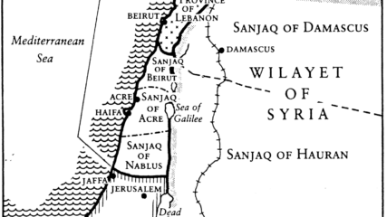
With more Arab sale offers than funds for purchases, Zionist leaders decide on strategic priorities and designate areas around Haifa, Jerusalem-Jaffa road, and the Galilee near headwaters of the
Jordan River.
1931-1949
Palestinian Arabs' own words, backed by the observations of British and Zionist officials, show that their awareness that their own people were helping the Zionist causes through land sales, often displacing Arab peasants.
May 23, 1939
Zionist leaders—David Ben-Gurion, Chaim Weizmann and Eliezer Kaplan—learning of the British intent to limit severely the Jewish national home’s growth. Increasingly, they are also aware of the German government’s hostilities towards European Jewry.
January 29, 2025
Kenneth Stein, “Palestine’s Rural Economy, 1917-1939,” Studies in Zionism, Vol. 8, No. 1 (1987), pp. 25-49. During the early decades of the 20th century in Palestine, the majority Arab population sustained itself primarily through agricultural and pastoral...
June 2020
Kenneth W. Stein, “Zionist Land Acquisition: a core element in establishing Israel,” in Michael J. Cohen, (ed.) The British Mandate in Palestine: A Centenary Volume, 1920-2020, Routledge, 2020, pp. 189-204.
November 10, 1946
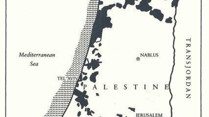
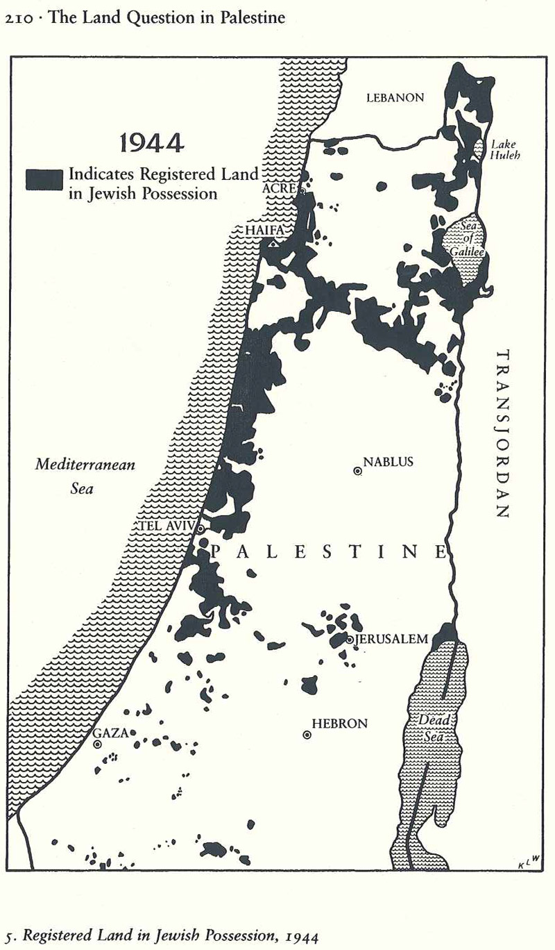
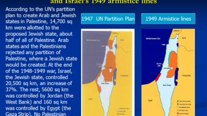
The JNF estimated that up to 250,000 dunams (a dunam was a quarter of an acre) could be purchased if funds were available despite Arab opposition to sales and a steep rise in prices. By then, Jews owned 1.6 million dunams of land, with more than half of Palestine not owned by anyone.
1926-1948
JNF meeting minutes and other statements show the strategic approach to Jewish land purchases throughout the British Mandate period.
February 19, 1936
Zionist leaders debate how to confront proposed British restrictions on Jewish land purchase in Palestine.
June 28, 2020
Using archival and published sources, including materials from the CIE website, CIE President Ken Stein identifies six factors as reasons for the Zionists’ success: Zionist political action, the impaired socio-economic condition of the Arab population,...
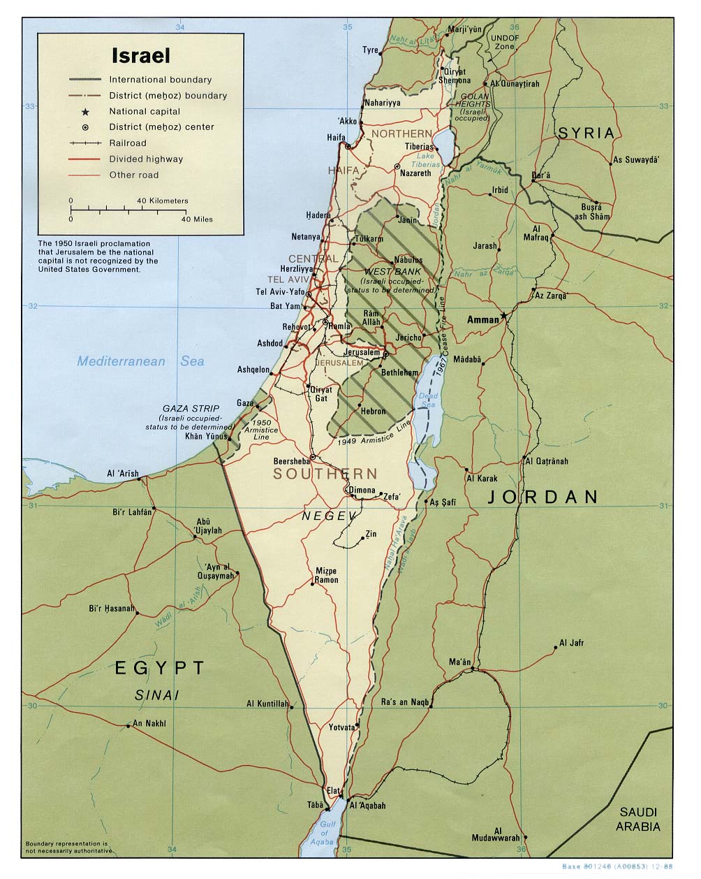
1920-1948
Primary sources, reputable scholarship and archival materials collectively show major communal (Arab-Jewish) socio-economic separation, factors that foreshadowed geo-spatial partition.
March 16, 1939
A British investigation in 1939, before the release of that year's anti-Jewish White Paper, finds that the area of Palestine was not promised to the Sharif of Mecca during World War I as part of a caliphate.
May 17, 1939
The 1939 White Paper signaled Britain’s readiness to relegate the Jews in Palestine to minority status in a future majority-Arab state.
Winter 2002
“A Zionist State in 1939,” Dr. Kenneth W. Stein, CHAI (Atlanta), Winter 2002 “Had not the Nazi crimes been committed against Jews during World War II, the Jewish State would have never come true.” So...
November 28, 1945
Circumventing the existing law on prohibition of land sales to Jews, Palestinian Arabs are found selling lands regularly and furtively to Zionists.
November 29, 1947
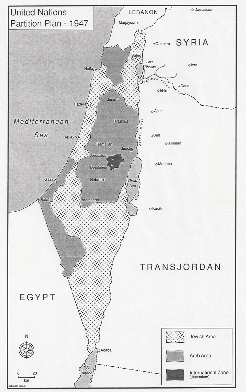
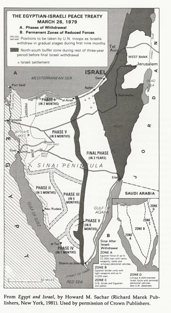
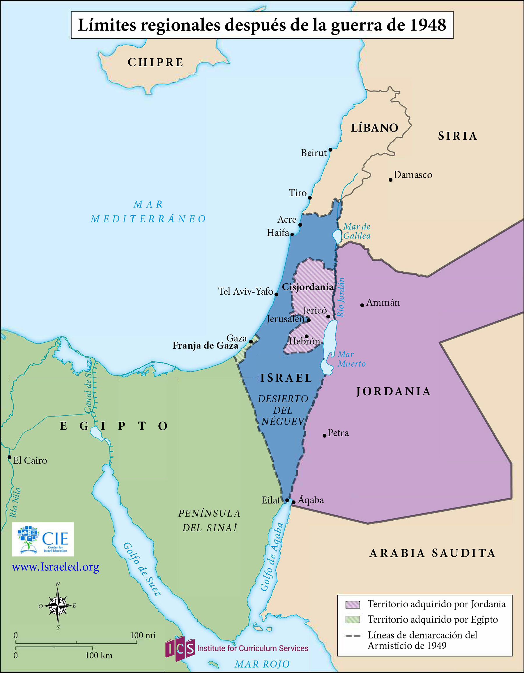
The 1937 plan to partition Palestine was never implemented. It did, however, remain a workable political option for resolving the conflict between Arabs and Zionists. Britain needed to placate Arab state opposition to Zionism, so it refrained from actively revisiting the partition plan.
1991
Kenneth W. Stein, “One Hundred Years of Social Change: The Creation of the Palestinian Refugee Problem,” in Laurence Silberstein (ed.), New Perspectives on Israeli History: The Early Years of the State, New York University Press,...
April 7, 2025
Stein, Kenneth, “Legal Protection and Circumvention of Rights for Cultivators in Mandatory Palestine,” in Joel S. Migdal, (Ed.) Palestinian Society and Politics, Princeton, (1980): 233-260. In the immediate wake of communal violence that plagued Palestine...


