The maps presented below are only a few that could be used in learning and teaching about Israel and the Middle East.
Diplomacy and war reflect the changing contours of states and borders along the evolution of Israel and the modern Middle East. We wish to thank the Israeli Ministry of Foreign Affairs for allowing us to use some of their published maps. Others were made for CIE use.
Max Fisher has assembled 40 maps of the Middle East from ancient times to the present, each of them with a brief paragraph introduction. This is a first rate collection of maps with almost no noticeable bias, with a devotion to accuracy. In addition, Michael Izady’s collection, the Gulf2000 project focuses on 8 countries of the Persian/Arabian Gulf.
At the bottom of Michael Izady’s site, other map collections are listed, including the fine collection at the University of Texas. On the Israel Ministry of Foreign Affairs website there is Israel’s Story in Maps. The story covers the Ancient Near East to the
present.
For Spanish-language maps, please click here.
For Hebrew-language maps, please click here.
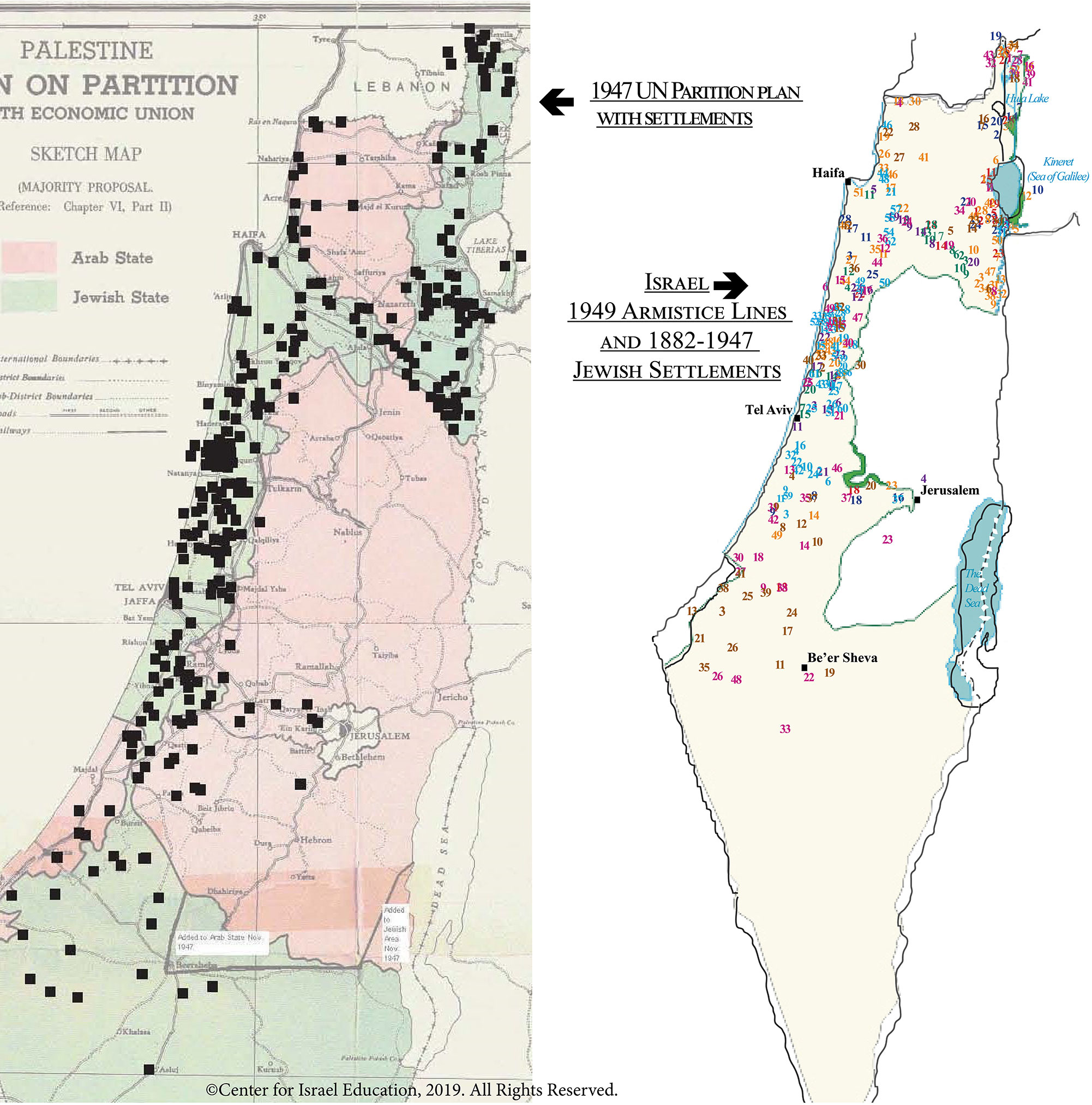
Forming a
Nucleus for the Jewish State: 1882-1947
For the idea of Zionism to become a territorial reality, Jews required a population and a territory. Creating facts
on the ground provided the future state with its demographic and physical nucleus. With 34 pages of original maps alongside contextual, historic descriptions, the story of Zionism’s steady growth is vividly shown and explained.
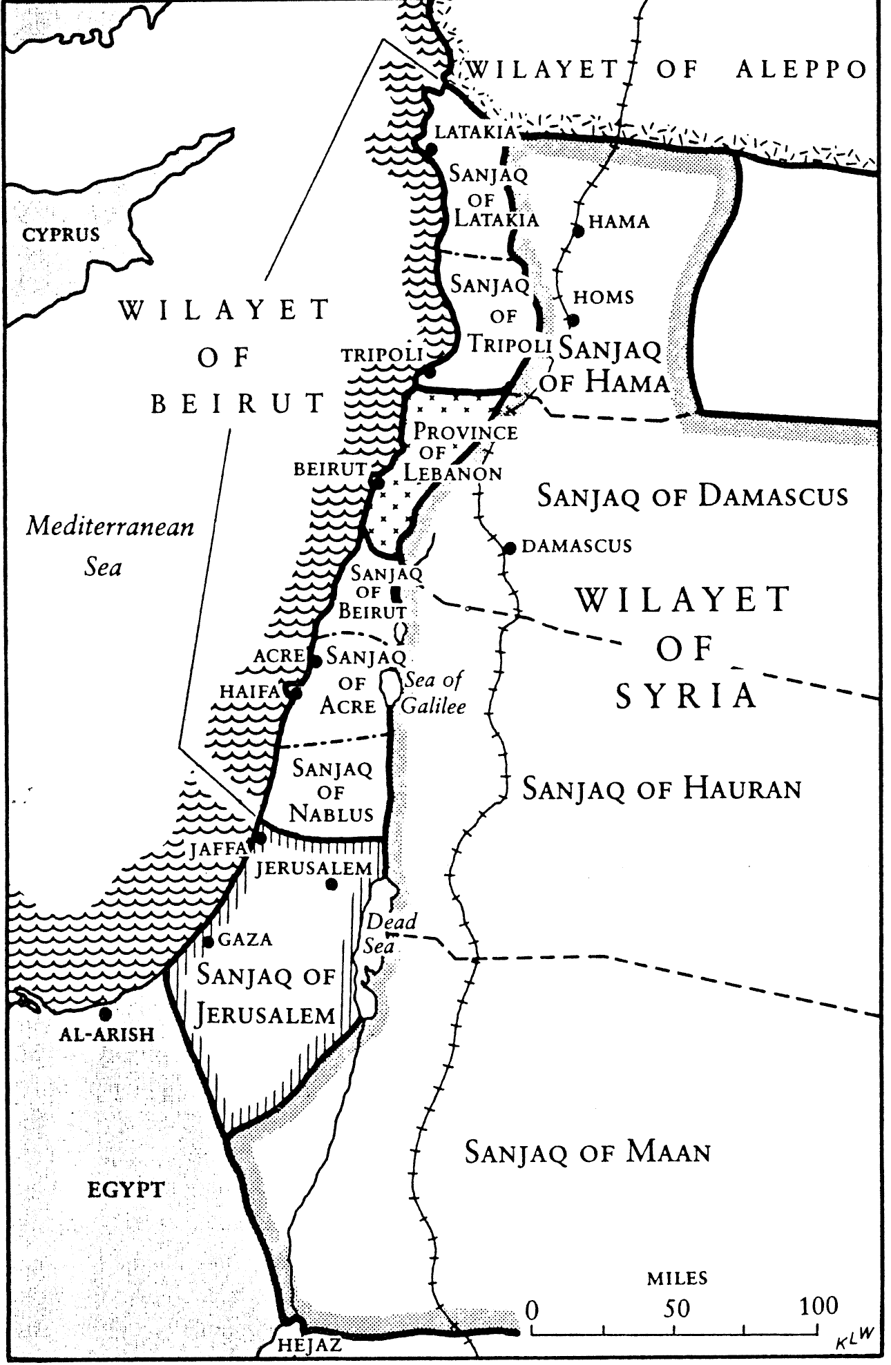
Future Area of Palestine and adjacent areas, 1890s
The area of Eretz Yisrael was part of the Ottoman Empire and composed of three large administrative areas without any political identity as a state or part of a state. At times, portions of the area that was later designated as the Palestine Mandate were ruled from Mecca, Damascus, or Baghdad, or in the case of Jerusalem, directly from Istanbul.
Printable PDF
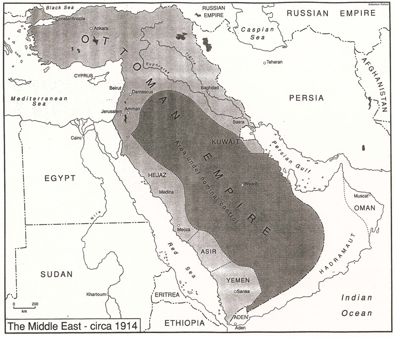
The Middle East Circa 1914
The region prior to the outbreak of WWI. After the War, Modern Middle Eastern states had their borders arbitrarily drawn by European powers.
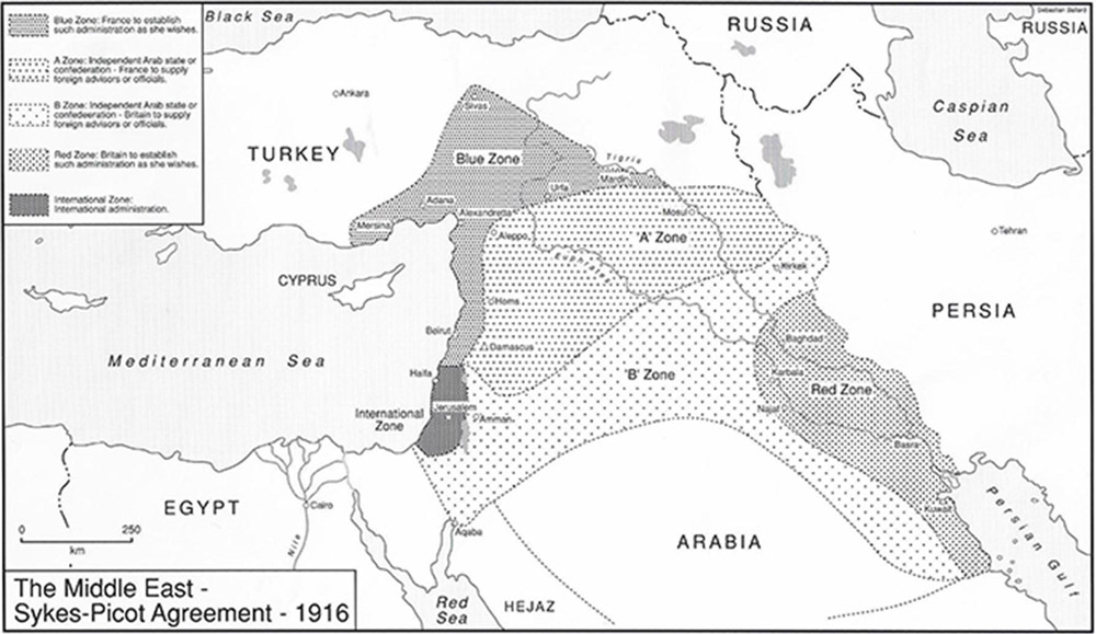
Sykes-Picot Agreement, 1916
The Russian, French, English secret agreement that carved up the Middle East into future areas of interest.
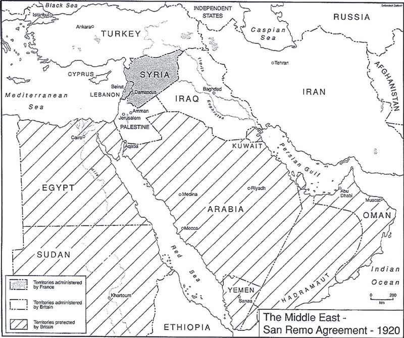
The San Remo Agreement, 1920
The European agreement that identified the states of the Middle East, 1920.
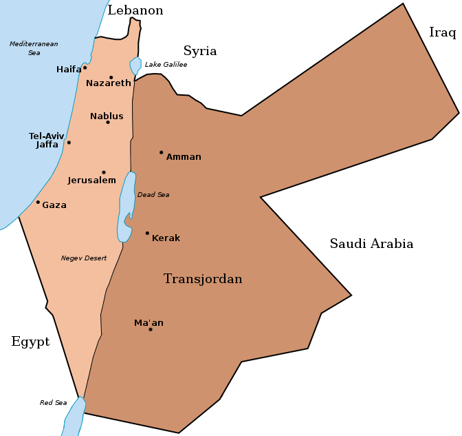
Palestine and Trans Jordan, 1922
When Britain controlled Palestine, she lopped off 80% of it and assigned it to the Hashemite family leader, Emir Abdullah. It became today’s Hashemite Kingdom of Jordan.
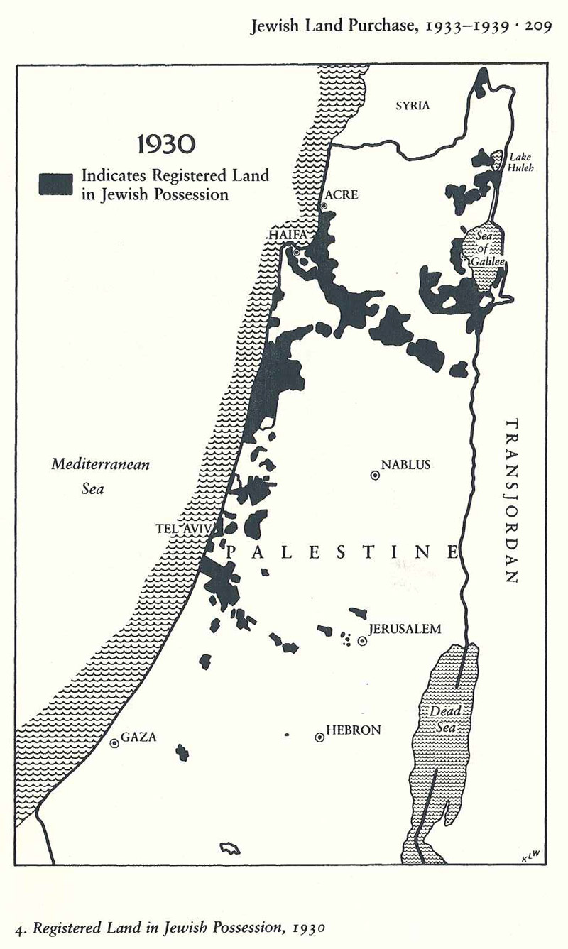
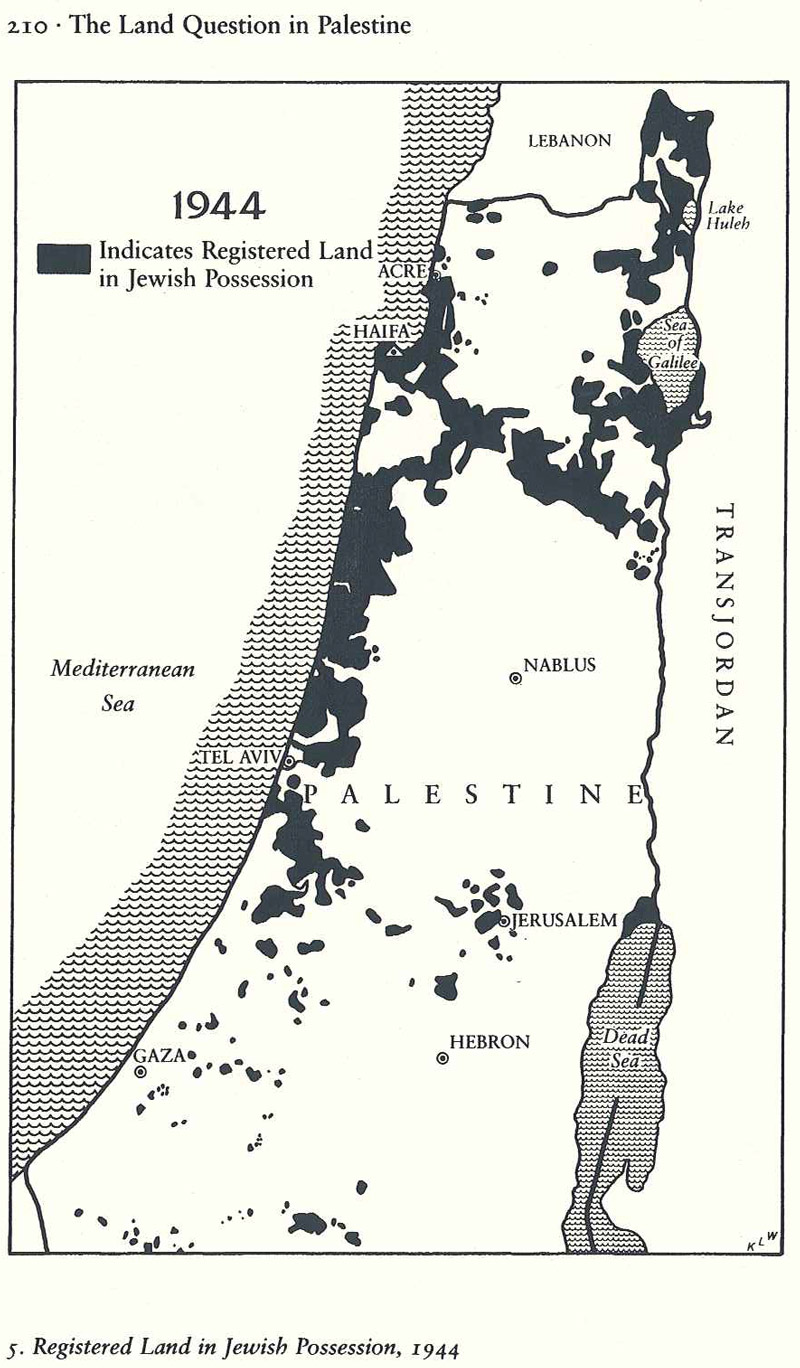
Registered Land in Jewish Possession, 1930
Jewish land acquisition in 1930 mostly in the valley and coastal regions.
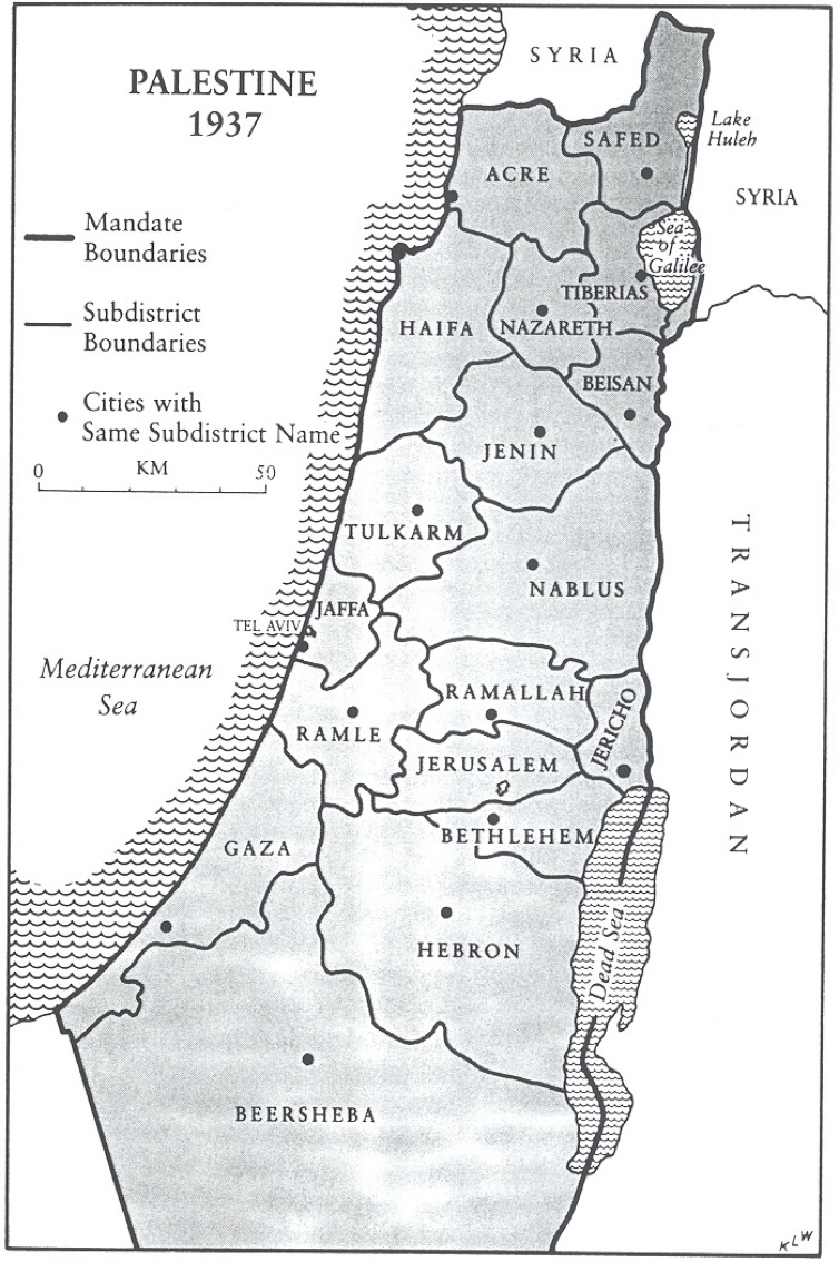
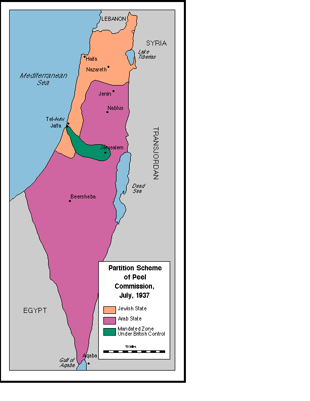
A Map of Palestine’s Administrative Boundaries, 1937
Stein, Kenneth W. The Land Question in Palestine, 1917-1939. North Carolina: University of North Carolina Press, 1984 and 2003. Copyright, Ken Stein and the Center for Israel Education, 2024.
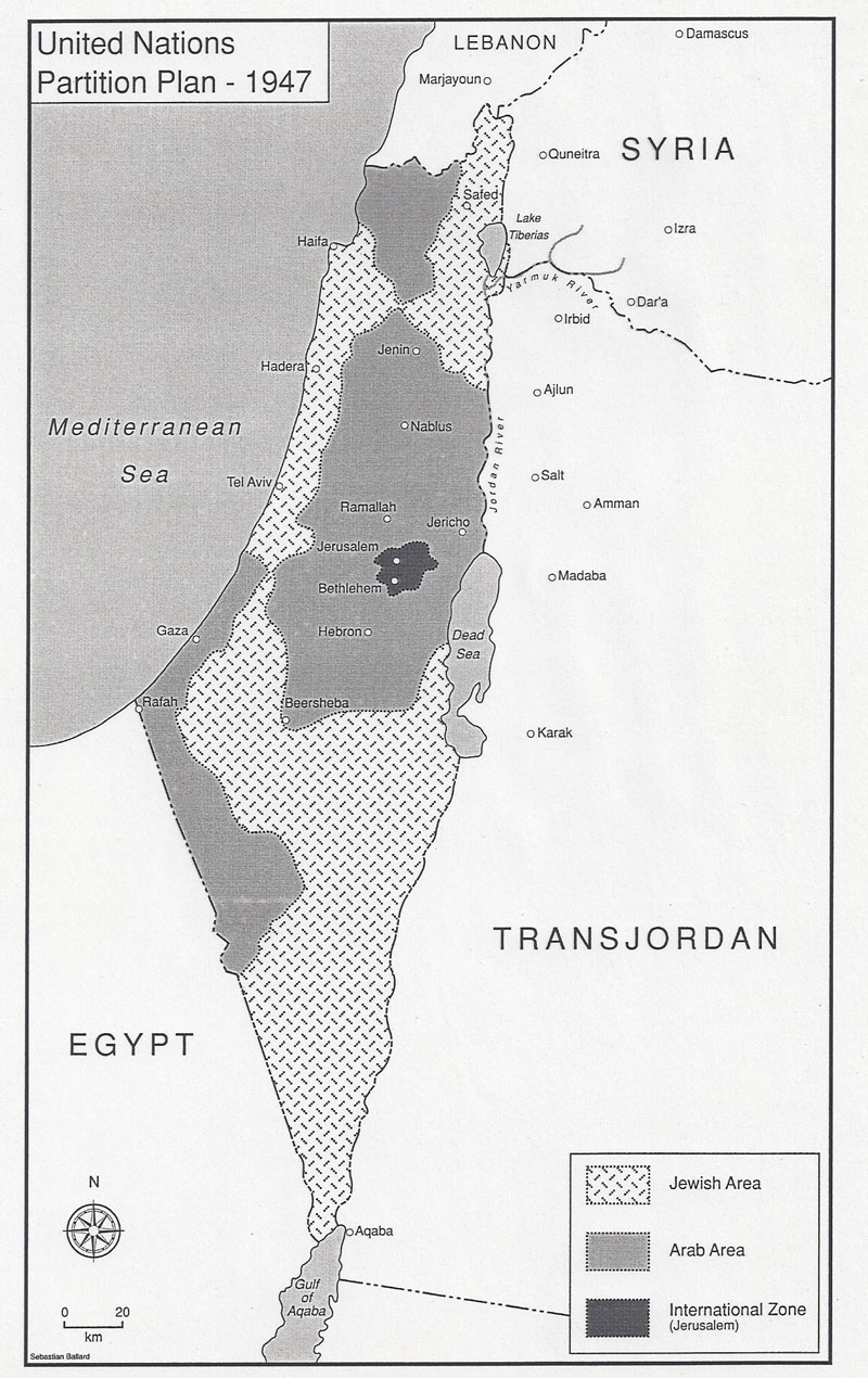
United
Nations Partition Plan, 1947
The UN suggested partition of Palestine into Arab and Jewish states with an economic union between them and an internationalization of Jerusalem.
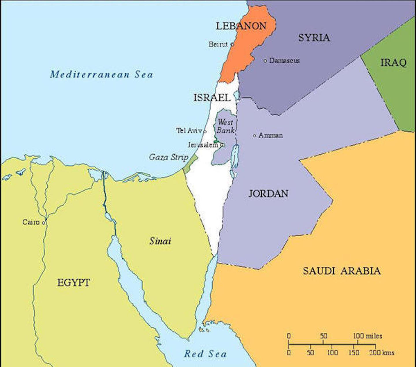
1949-1967 Armistice Lines
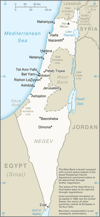
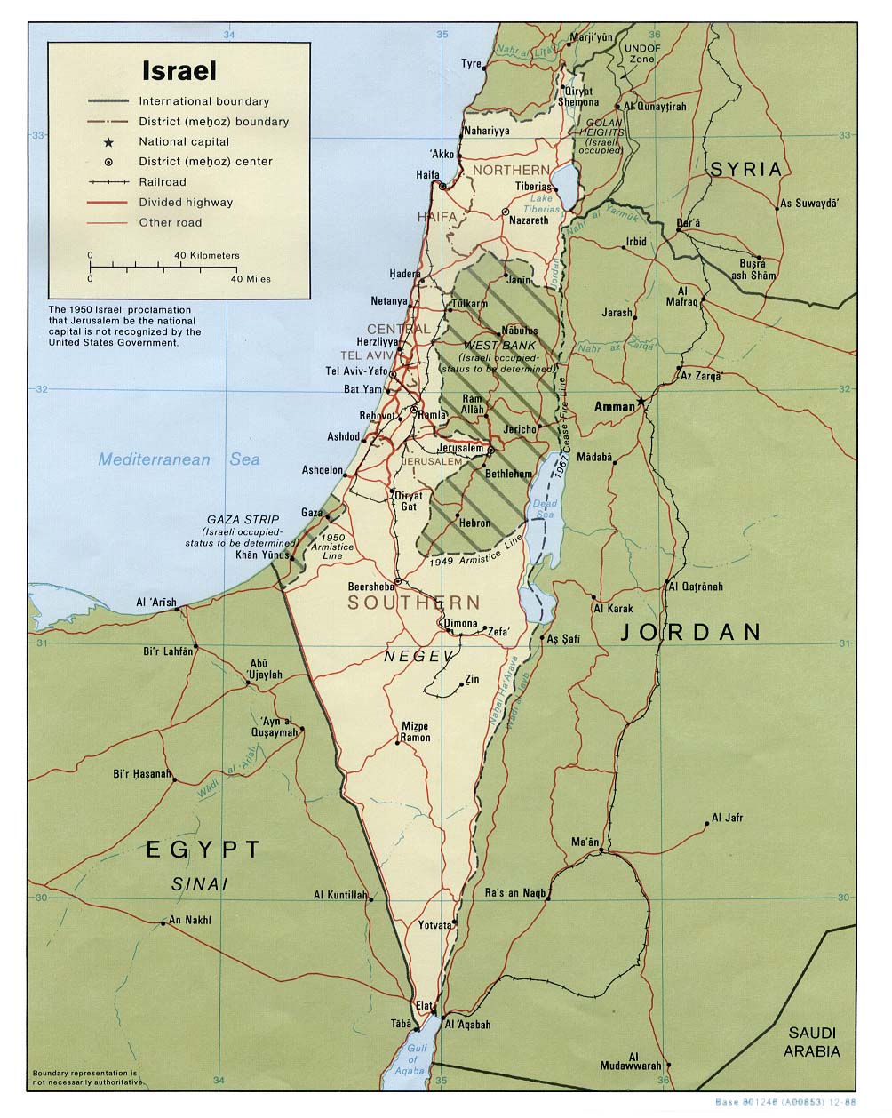
In the aftermath of the 1948 War of Independence, Israel signed armistice agreements with Egypt, Jordan, Syria, and Lebanon. These armistice lines lasted until the immediate aftermath of the June 1967 War. Israel has 1068 kilometers in land borders. Egypt 208 km, Gaza Strip 59 km, Jordan 307 km, Lebanon 81 km, Syria 83 km, and the West Bank 330 km; its Mediterranean coastline 273 km. CIA The World Factbook – Israel

Israel and the Occupied Territories, 1967
As a result of the June 1967 War, Israel increased its size seven fold to include Eastern Jerusalem, the Golan Heights, the West Bank of the Jordan River, and the Gaza Strip.
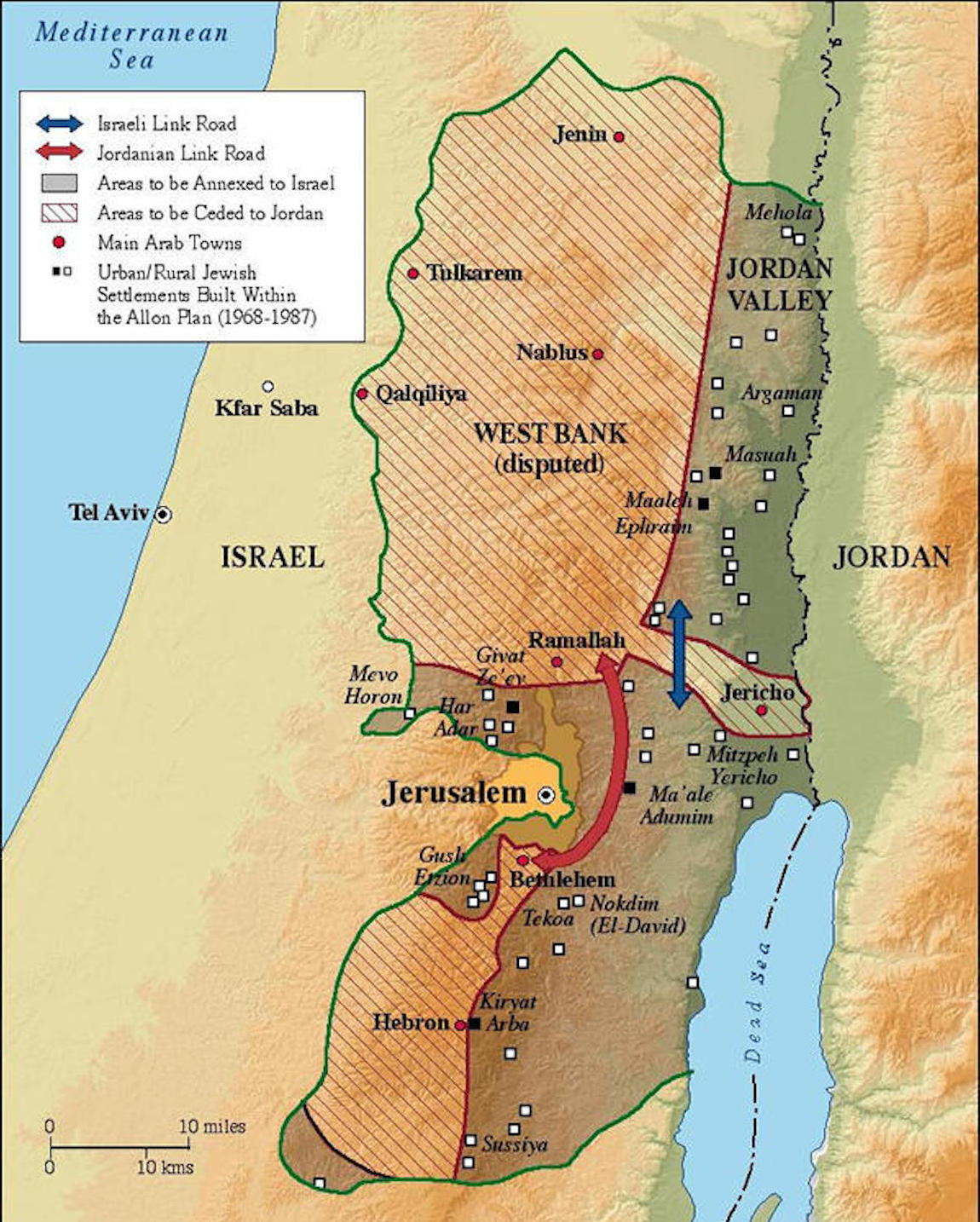
The Alon Plan – 1968
Drafted by Minister of Labor Yigal Alon after the June 1967 War, the plan envisages Israeli retention of a series of settlements and military installations along the Jordan Valley, as buffers to a potential Arab land attack from the east. The plan was never implemented.

October War – Operation Gazelle – October 15-17, 1973
Israel troop crossings with Egyptian counterattacks, Israeli forces led by Generals Sharon, Aden and Magen; Description of Israel Suez Canal crossing, Israel State Archives, October War
A Map of Israeli-Egyptian Separation of Forces Agreement, 1974
For Sadat, who had gone to war against Israel three months earlier, securing a military disengagement agreement was important. In addition, diplomatically engaging the US to secure the agreement meant entrenching Washington as a friend of Egypt. The US embraced the opportunity to quell tensions between Israel and Egypt, while squiring Cairo away from decades of Moscow’s embrace. Israel had its POWs returned and slowly tested Sadat’s broader intentions toward Jerusalem.
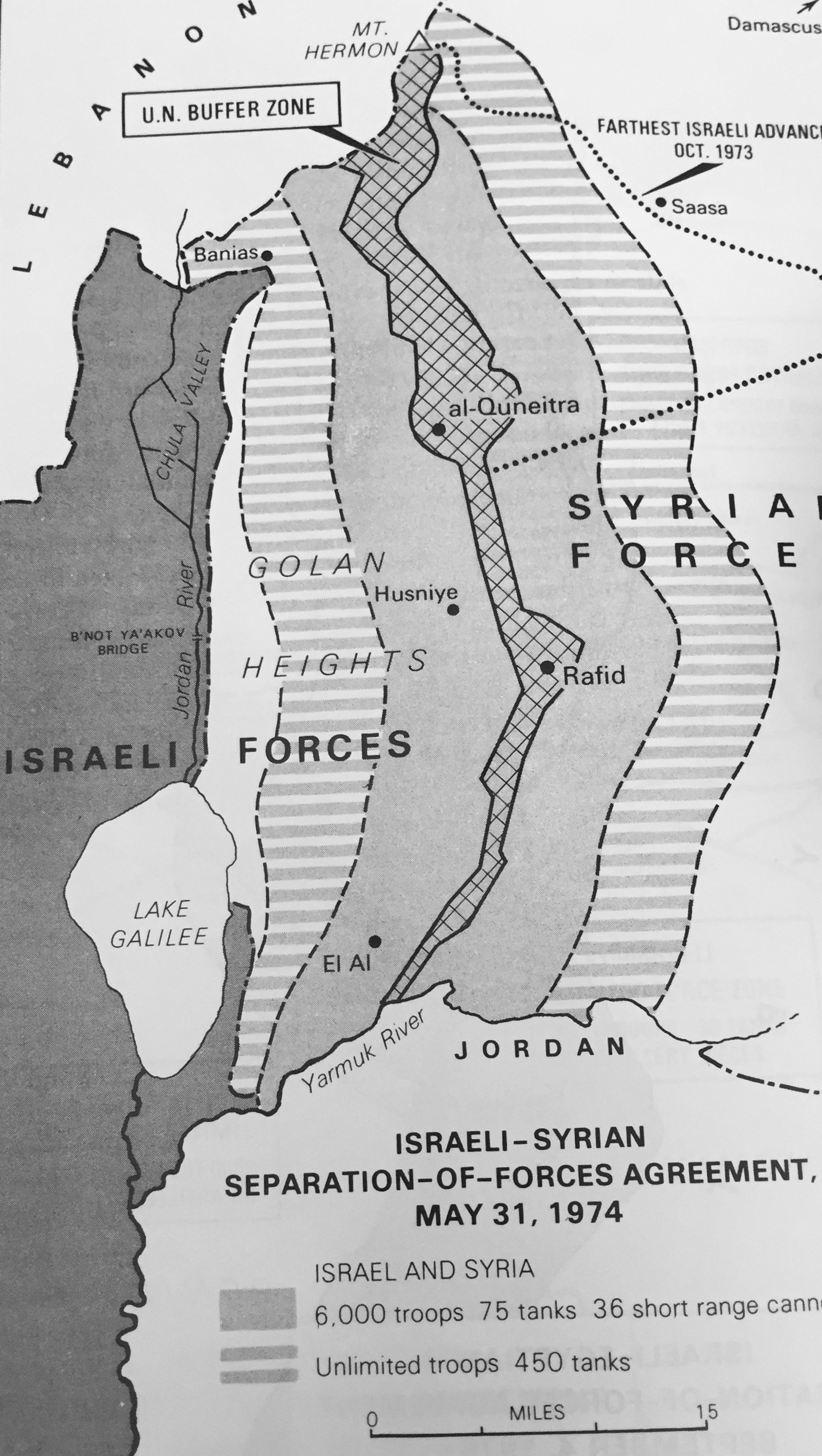
Golan Heights after May 1974 Israeli Syrian Separation of Forces
agreement
In the last days of the June 1967 War Israel secured a portion of the Syrian Golan Heights, estimated at 1300 sq km or 500 sq mi; Israel forces sit some 40 miles, 60km from Damascus. Before the June War, Israeli villages and populations in the valley were fired upon by Syrian forces from the Heights. In addition to being an important catchment for Jordan River waters which helps supply Israel’s water needs, the heights contain not fully explored hydrocarbon sources. In the northern Heights is Mt. Hermon which has strategic value for observing military movements into southern Lebanon and to Damascus.
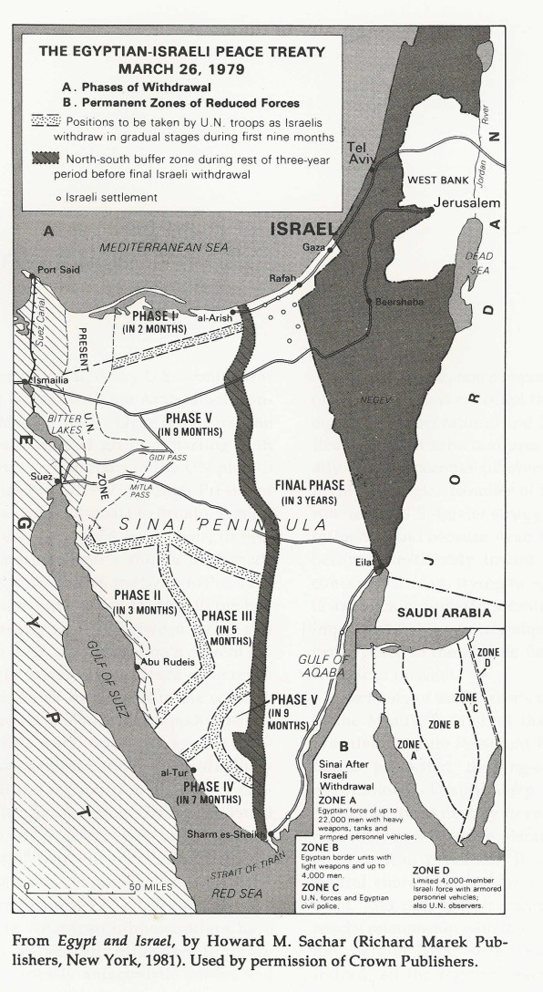
The Egyptian-Israeli Peace Treaty, March 26, 1979
To test Egypt’s intentions, Israel took eight years, from January 1974 to April 1982, to withdraw from virtually all of Sinai.
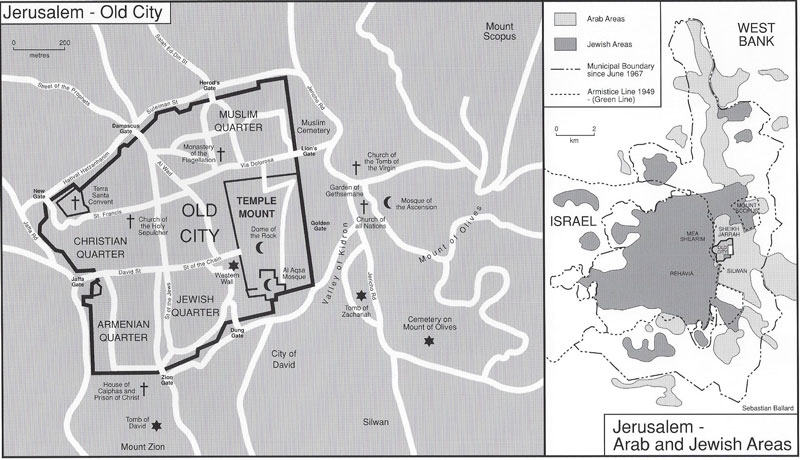
Jerusalem- Old City, 1988
The Old City of Jerusalem is divided into four religious quarters: Armenian, Christian, Jewish and Moslem areas. The overall population of the Old City is 34,000, 11 per cent of whom are Jews; Jews comprise 59 per cent of the population of the Old City’s Jewish Quarter and 49 per cent of the Armenian Quarter.
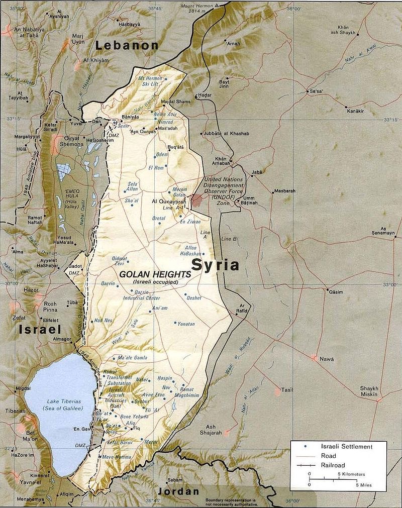
Israeli Settlements on the Golan Heights, July 1989
After Israel secured the Golan Heights in the June 1967 War, the Israeli government offered to negotiate its return, some 1300 km, for a peace treaty with Israel. Israel withdrew from a small portion of the Heights after the 1973 War. It continued to build Israeli settlements in strategic locations and in 1981 applied Israeli law to the area. Some 20,000 Israelis live there in 32 settlements, along with 20,000 Druze.
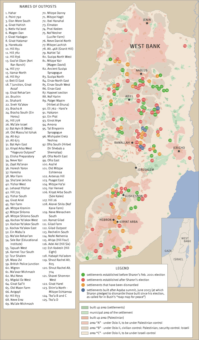
Map of Jewish Settlements in the West Bank as of January 2005.
As an unintended consequence of the June 1967 War, Israel found itself controlling the entire West Bank of the Jordan River, amounting to 2,300 square miles with 680,000 Palestinian living in 396 villages, towns and in portions of Jerusalem. From 1976 forward, the US and the international community in general have labelled the settlements as either
“illegal” or as an “obstacle to peace.” The growth of the settlements or their expansion has occurred in a spatial manner that places Israeli settler populations in between Arab villages and towns in order to limit or prevent Arab contiguity in the West Bank.
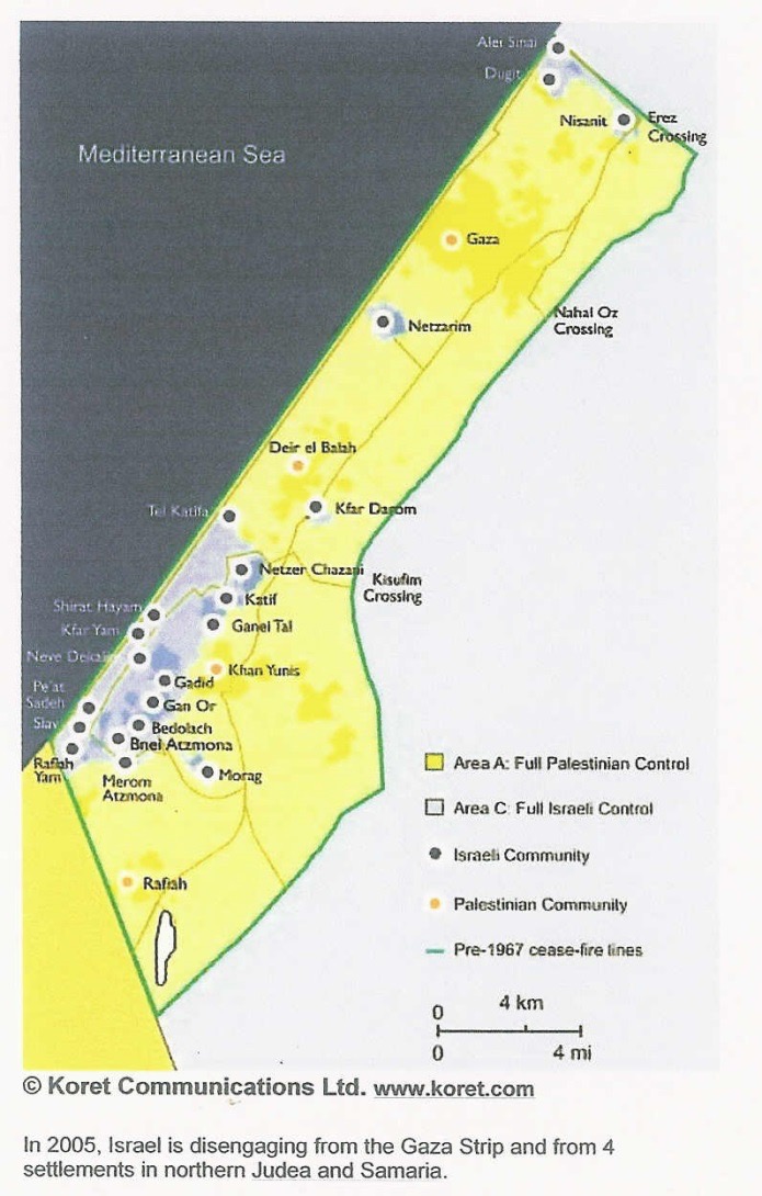
Jewish settlements in Gaza, August 2005
From 1977-1979, the settler population in the territories grew from 3,200 to 17,500, plus 80,000 in East Jerusalem. Of the 225,000 Israel settlers in the “territories,” in 2005, all 8,500 settlers living in Gaza (5% of the total) were evacuated with the area turned over to the Palestinian Authority. Later in 2006, Hamas conducted a coup and ousted the Palestinian Authority from Gaza.
Printable Image

Map of Lebanon, 2006
The map includes the Israeli border and the Litani River, is 18 miles long running almost parallel to the Israeli-Lebanese border.
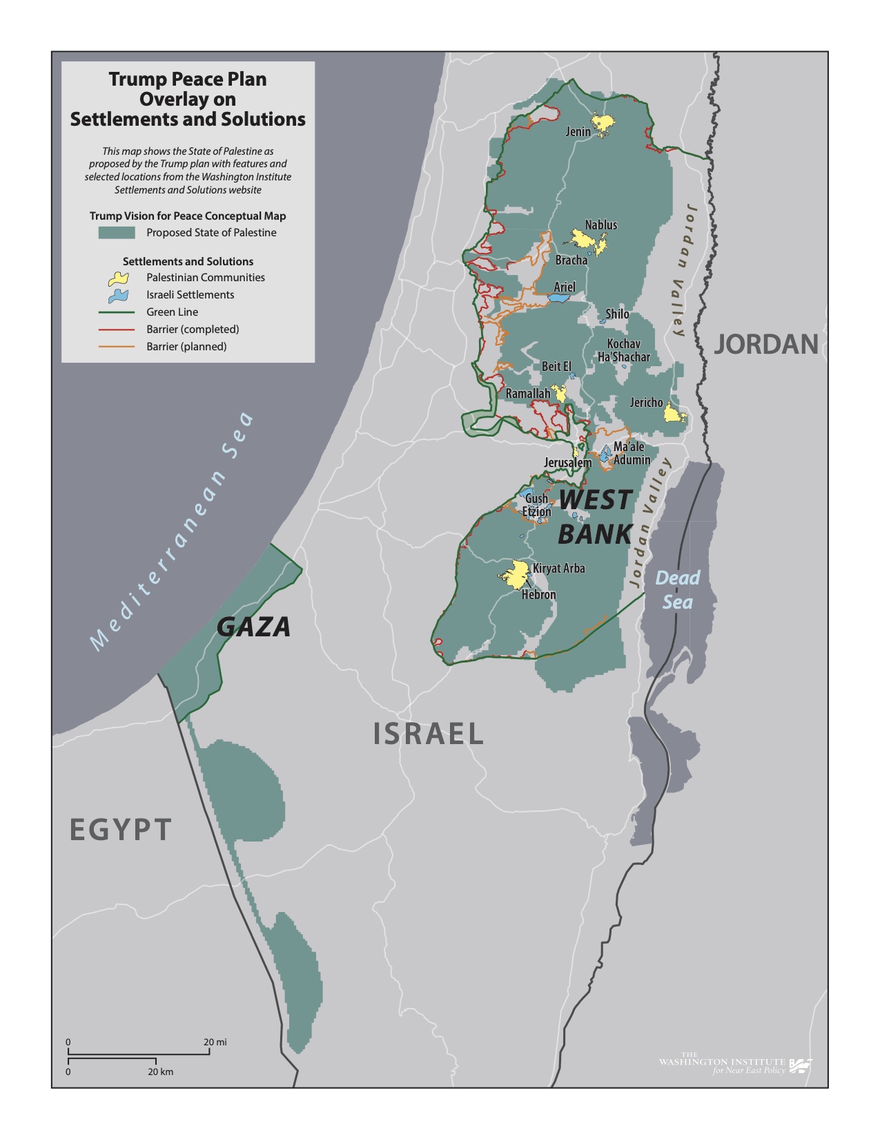
Trump Peace Plan Overlay on Settlements and Solutions, 2020
This map shows the State of Palestine as proposed by the Trump plan with features and selected locations from the
Washington Institute Settlements and Solutions website
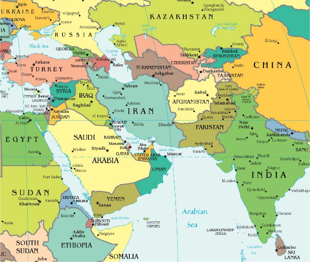
Afghanistan and the Middle Eastern neighborhood, 2021
Courtesy of the University of Texas, Map Collection, https://maps.lib.utexas.edu/maps/

