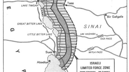
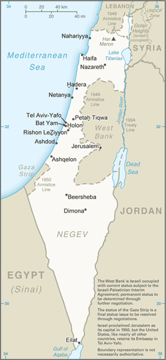
Map of Israeli-Egyptian Separation of Forces Agreement, January 1974CIE+
For Sadat, who had gone to war against Israel three months earlier, securing a military disengagement agreement was important. In addition, diplomatically engaging the US to secure the agreement meant entrenching Washington as a friend of Egypt. The US embraced the opportunity to quell tensions between Israel and Egypt, while squiring Cairo away from decades of Moscow’s embrace. Israel had its POWs returned and slowly tested Sadat’s broader intentions toward Jerusalem.


