The maps presented below are only a few that could be used in learning and teaching about Israel and the Middle East.
CIE wishes to thank Aliza Cramer Elias and her team at the
Institute for Curriculum Services for allowing CIE to promote the use of the maps that they produced, found here in English and in Spanish.
Diplomacy and war reflect the changing contours of states and borders along the evolution of Israel and the modern Middle East. We wish to thank the Israeli Ministry of Foreign Affairs for allowing us to use some of their published maps. Others were made for CIE use.
Max Fisher has assembled
40 maps of the Middle East from ancient times to the present, each with a brief introduction. This is a first-rate collection with almost no noticeable bias and with a devotion to accuracy.
In addition, Michael Izady’s collection, the
Gulf2000 project, focuses on eight countries of the Persian/Arabian Gulf. Izady also lists other map collections, including
the Library of Congress, rich in historical items.
The University of Texas also has a
fine collection of Middle East maps, most of them drawn from the public-domain collection
created by the CIA.
Israel’s Ministry of Foreign Affairs provides
contemporary and historical maps of Israel and its neighborhood.
For Spanish-language maps, please click here.
For Hebrew-language maps, please click here.
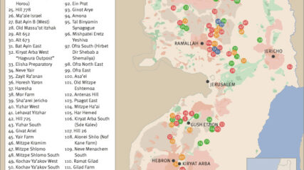
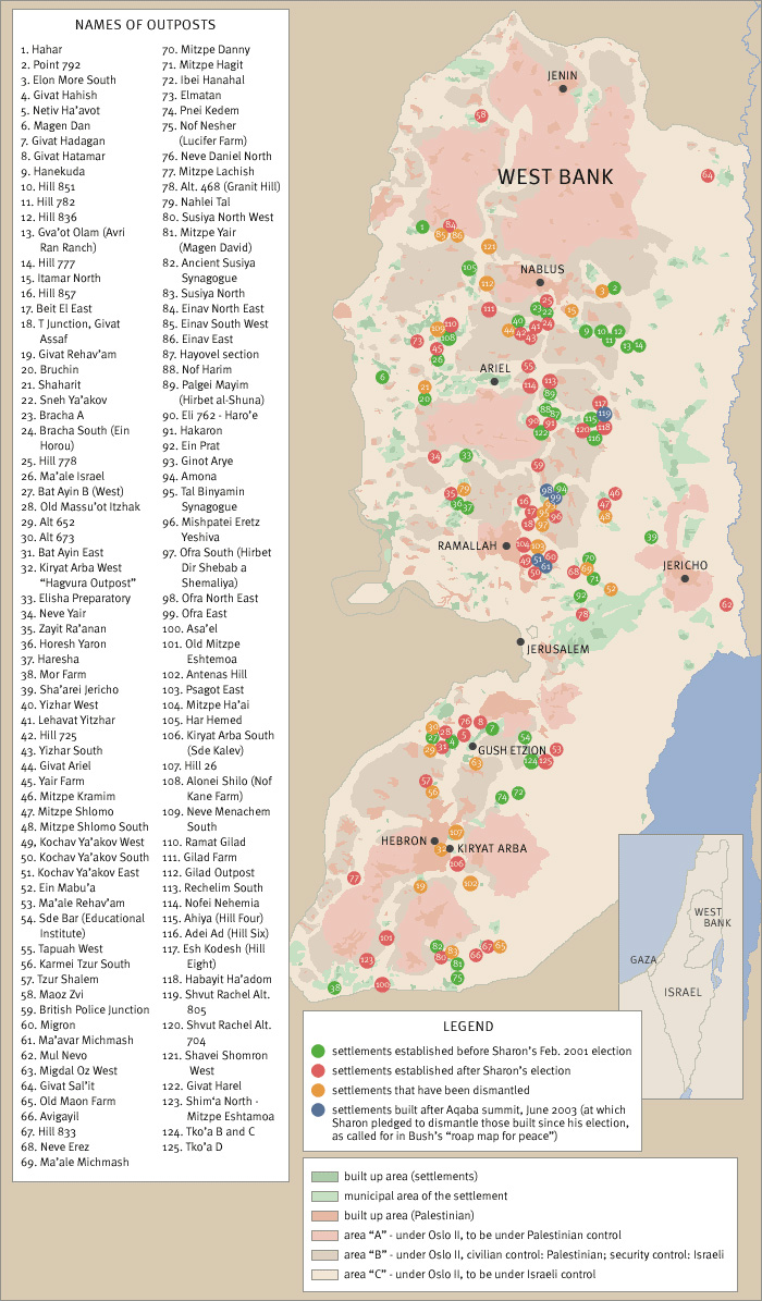
As an unintended consequence of the June 1967 War, Israel found itself controlling the entire West Bank of the Jordan River, amounting to 2,300 square miles with 680,000 Palestinian living in 396 villages, towns and in portions of Jerusalem. From 1976 forward, the US and the international community in general have labelled the settlements as either“illegal” or as an “obstacle to peace.” The growth of the settlements or their expansion has occurred in a spatial manner that places Israeli settler populations in between Arab villages and towns in order to limit or prevent Arab contiguity in the West Bank.
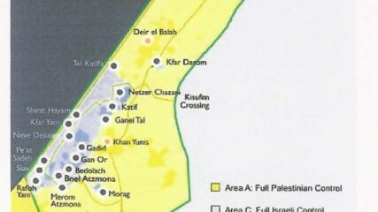
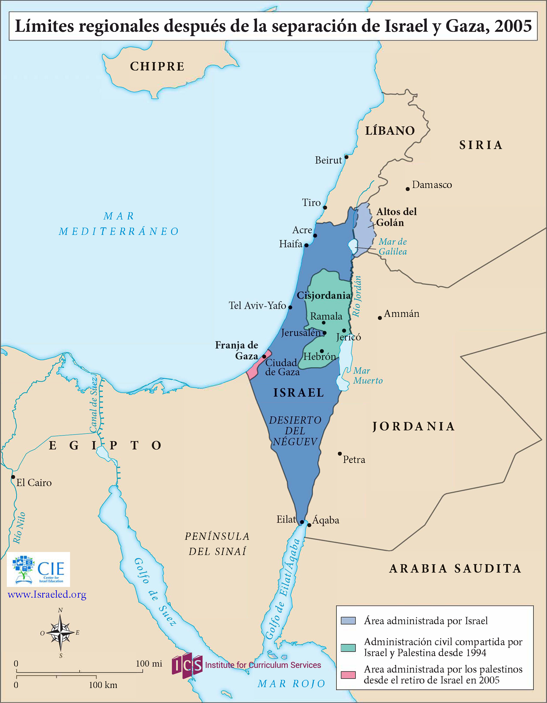
From 1977 to 1979, the settler population in the territories grew from 3,200 to 17,500, plus 80,000 in East Jerusalem. Of the 225,000 Israel settlers in the “territories” in 2005, all 8,500 settlers living in Gaza (5% of the total) were evacuated with the area turned over to the Palestinian Authority. In 2006, Hamas won Palestinian legislative elections, and in 2007 the terrorist group conducted a coup and ousted the Palestinian Authority from Gaza.
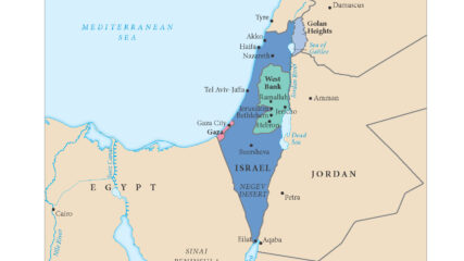
This regional map shows Israel and its neighbors after the Israeli withdrawal from the Sinai Peninsula, completed in 1982, and the disengagement from the Gaza Strip in August 2005.
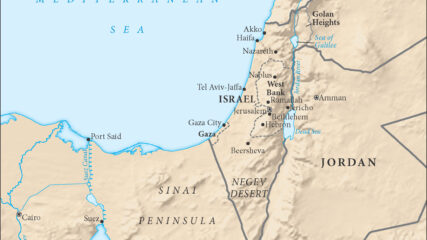
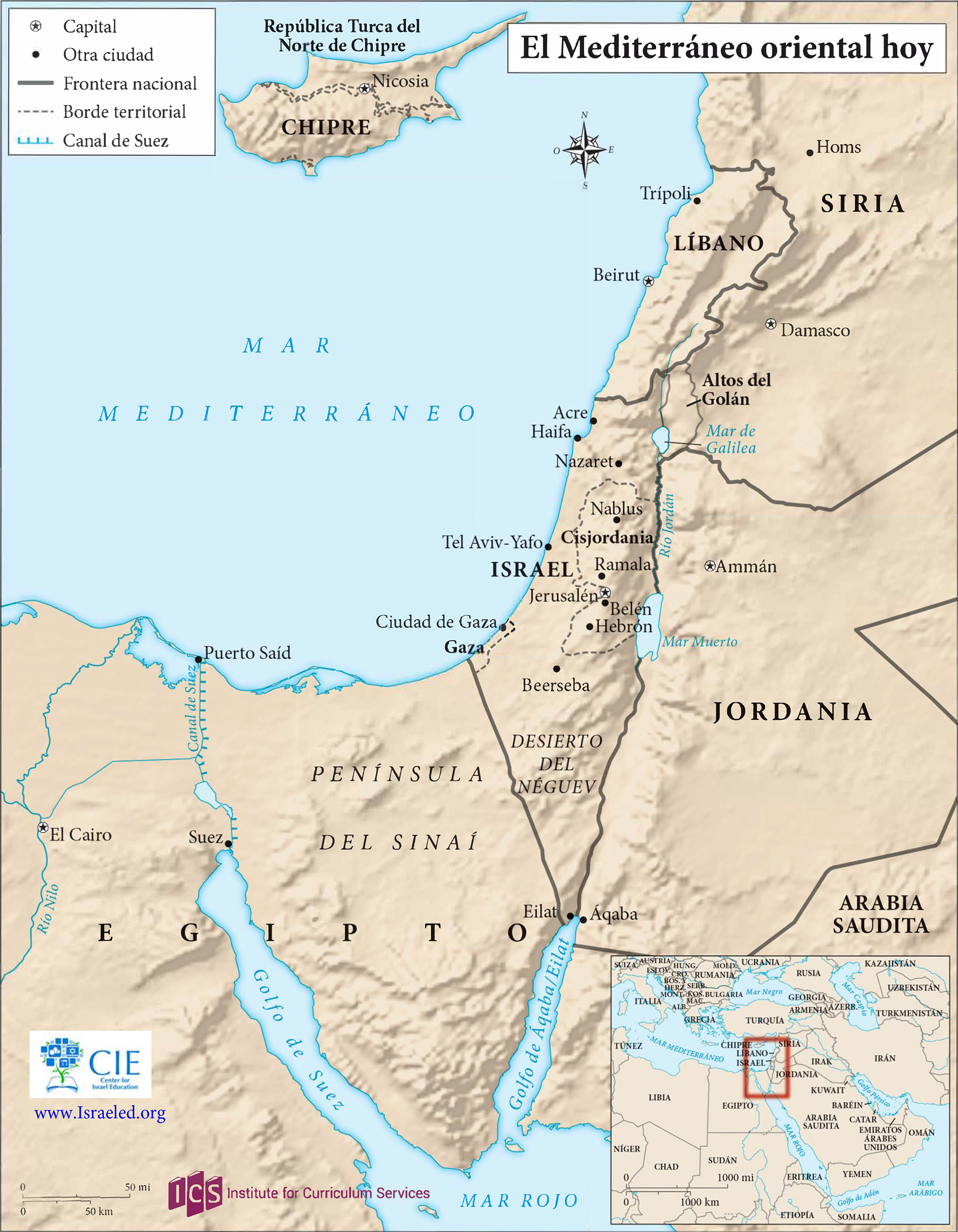
This 2018 map of the eastern Mediterranean, which remains current, shows all of Israel, Gaza, the West Bank, Lebanon and Cyprus, plus parts of Syria, Jordan, Egypt and Saudi Arabia, within the context of the Middle East as a whole.