The maps presented below are only a few that could be used in learning and teaching about Israel and the Middle East.
CIE wishes to thank Aliza Cramer Elias and her team at the
Institute for Curriculum Services for allowing CIE to promote the use of the maps that they produced, found here in English and in Spanish.
Diplomacy and war reflect the changing contours of states and borders along the evolution of Israel and the modern Middle East. We wish to thank the Israeli Ministry of Foreign Affairs for allowing us to use some of their published maps. Others were made for CIE use.
Max Fisher has assembled
40 maps of the Middle East from ancient times to the present, each with a brief introduction. This is a first-rate collection with almost no noticeable bias and with a devotion to accuracy.
In addition, Michael Izady’s collection, the
Gulf2000 project, focuses on eight countries of the Persian/Arabian Gulf. Izady also lists other map collections, including
the Library of Congress, rich in historical items.
The University of Texas also has a
fine collection of Middle East maps, most of them drawn from the public-domain collection
created by the CIA.
Israel’s Ministry of Foreign Affairs provides
contemporary and historical maps of Israel and its neighborhood.
For Spanish-language maps, please click here.
For Hebrew-language maps, please click here.
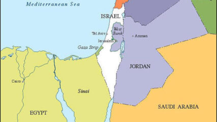
In the aftermath of the 1948 War of Independence, Israel signed armistice agreements with Egypt, Jordan, Syria, and Lebanon. These armistice lines lasted until the immediate aftermath of the June 1967 War. Israel has 1068 kilometers in land borders. Egypt 208 km, Gaza Strip 59 km, Jordan 307 km, Lebanon 81 km, Syria 83 km, and the West Bank 330 km; its Mediterranean coastline 273 km. CIA The World Factbook – Israel
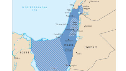
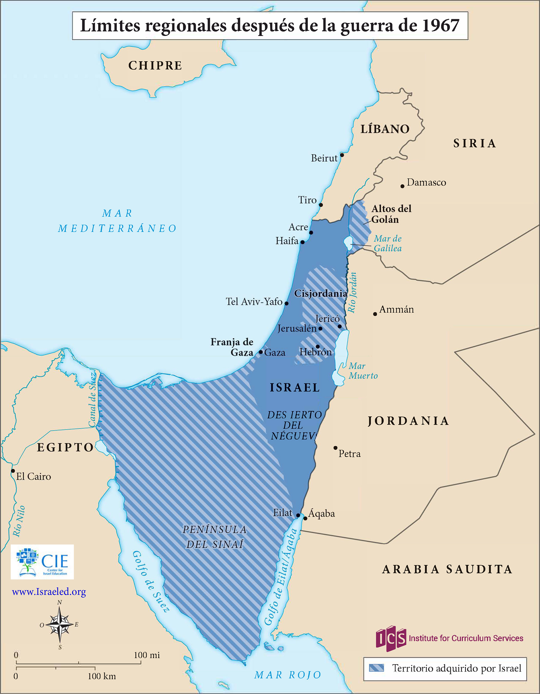
With its six-day victory in the June 1967 war, Israel added the Sinai Peninsula, the Gaza Strip, the Golan Heights and the West Bank (Judaea and Samaria) to the territory under its control. Israelis moved into all of those areas over the next decade.
As a result of the June 1967 War, Israel increased its size seven fold to include Eastern Jerusalem, the Golan Heights, the West Bank of the Jordan River, and the Gaza Strip.

Drafted by Minister of Labor Yigal Allon after the June 1967 war, the plan envisages Israeli retention of a series of settlements and military installations along the Jordan Valley as buffers to a potential Arab land attack from the east.
