Map of the Middle East, Circa 1914CIE+
The region prior to the outbreak of World War I. After the war, modern Middle Eastern states had their borders arbitrarily drawn by European powers.
![]()
By Topic
Find content relevant to your specific interests or area of study.
By Type
Choose the format that best suits how you want to engage with the content.
By Language
Access content in the language that best supports your learning.
By Era
Explore content organized by historical period to focus your learning by timeframe.
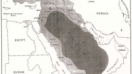
The region prior to the outbreak of World War I. After the war, modern Middle Eastern states had their borders arbitrarily drawn by European powers.
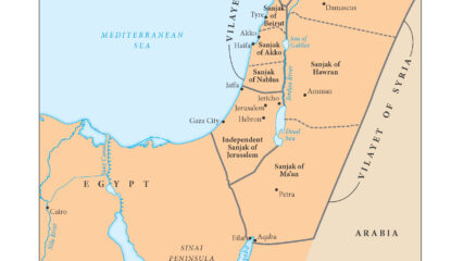
This map shows the Ottoman Empire’s administrative districts before World War I broke out in August 1914 in areas that today are Israel, Gaza, the West Bank, Lebanon, Jordan, Syria and part of Iraq.
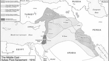
A map showing the Russian-French-English secret agreement that carved up the Middle East into future areas of interest.
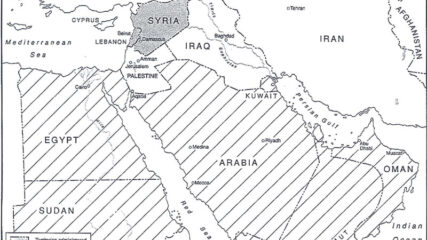
The European agreement that identified the states of the Middle East, 1920.

A map shows the partition of Palestine proposed by the Peel Commission in 1937.
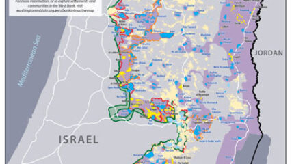
Israeli prime minister Binyamin Netanyahu has repeatedly declared that he will be putting forward his proposal for West Bank annexation as early as July 1. Yet uncertainties about his plans still abound, indicating that this timetable may not be met despite his assertions to the contrary.
We use cookies to understand how visitors use our site and to show relevant content across the web. You can accept everything, reject non-essential cookies, or customize your choices. Privacy policy.