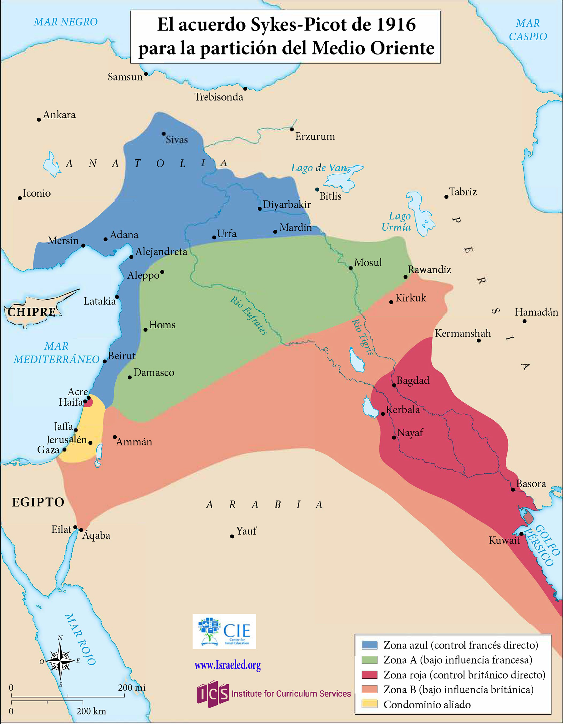
Map of Sykes-Picot Agreement, 1916CIE+
A map showing the Russian-French-English secret agreement that carved up the Middle East into future areas of interest.
![]()
By Topic
Find content relevant to your specific interests or area of study.
By Type
Choose the format that best suits how you want to engage with the content.
By Language
Access content in the language that best supports your learning.
By Era
Explore content organized by historical period to focus your learning by timeframe.
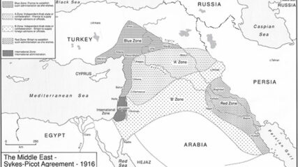
A map showing the Russian-French-English secret agreement that carved up the Middle East into future areas of interest.
Great Britain and France secretly negotiated the Sykes-Picot Agreement in 1916. The two European powers agreed, according to their respective spheres of influence, to divide the Middle East territories previously administered by the Ottoman Empire.

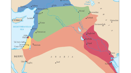
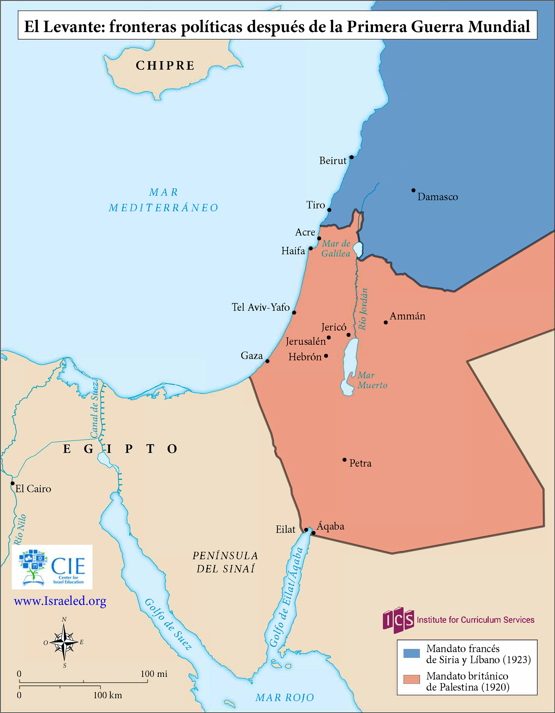
The British and French zones of influence, or mandates, in the eastern Mediterranean region were ratified by the San Remo Agreement in 1920 and approved by the League of Nations in 1922.
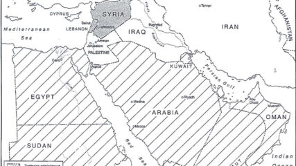
The European agreement that identified the states of the Middle East, 1920.
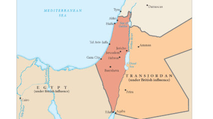
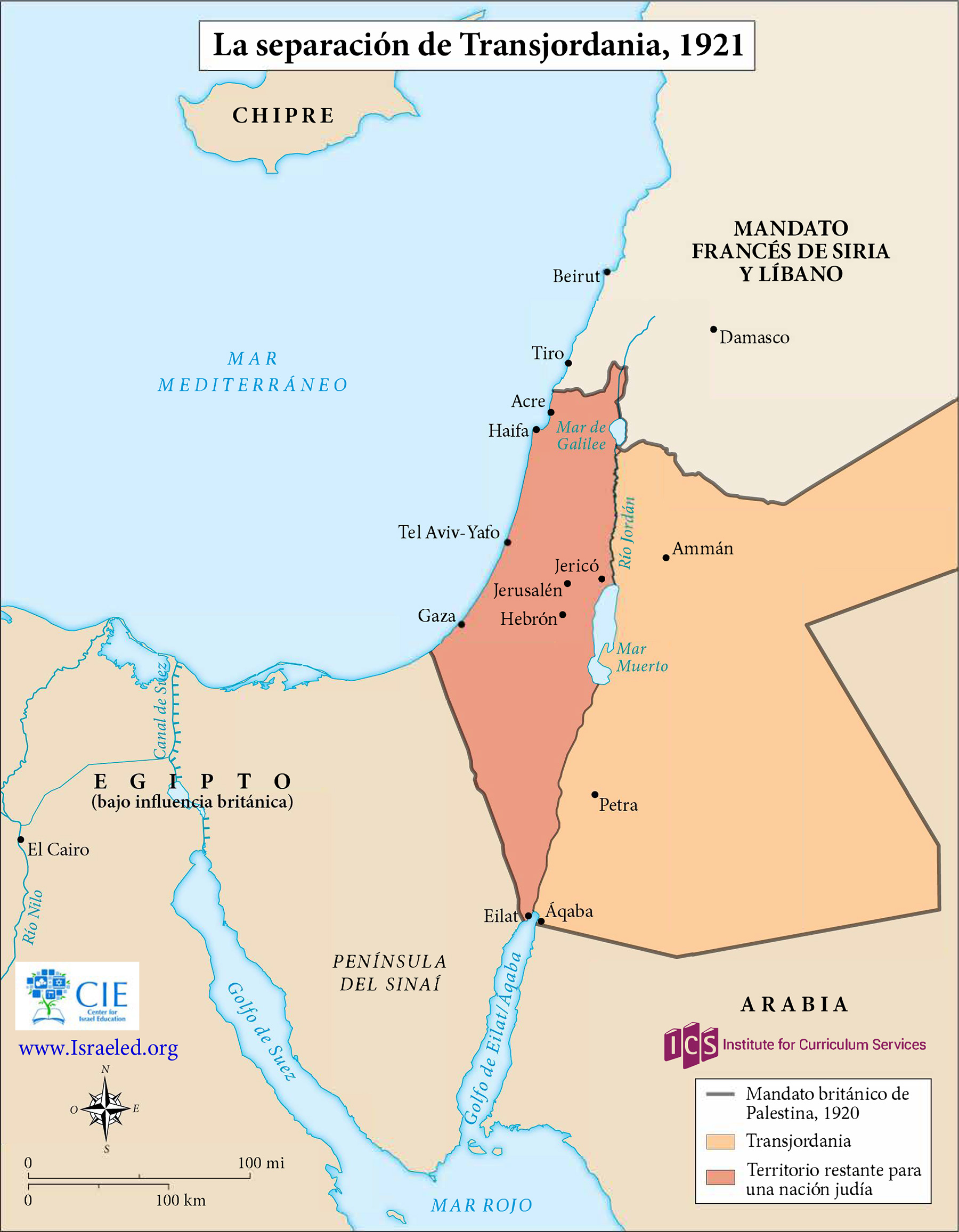
As shown in this map, the British in 1921 separated a new emirate, Transjordan, from what officially became the Mandate for Palestine the next year. The British officially maintained political and military control of both areas until withdrawing in 1948.
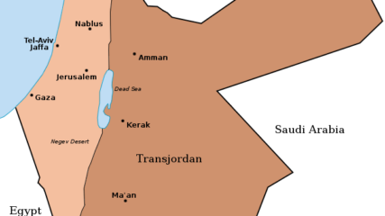
When Britain controlled Palestine, she lopped off 80% of it and assigned it to the Hashemite family leader, Emir Abdullah. It became today’s Hashemite Kingdom of Jordan.

Stein, Kenneth W. The Land Question in Palestine, 1917-1939. North Carolina: University of North Carolina Press, 1984 and 2003. Copyright, Ken Stein and the Center for Israel Education, 2024.

A map shows the partition of Palestine proposed by the Peel Commission in 1937.
We use cookies to understand how visitors use our site and to show relevant content across the web. You can accept everything, reject non-essential cookies, or customize your choices. Privacy policy.