Map of the Levant’s Political Boundaries After World War ICIE+
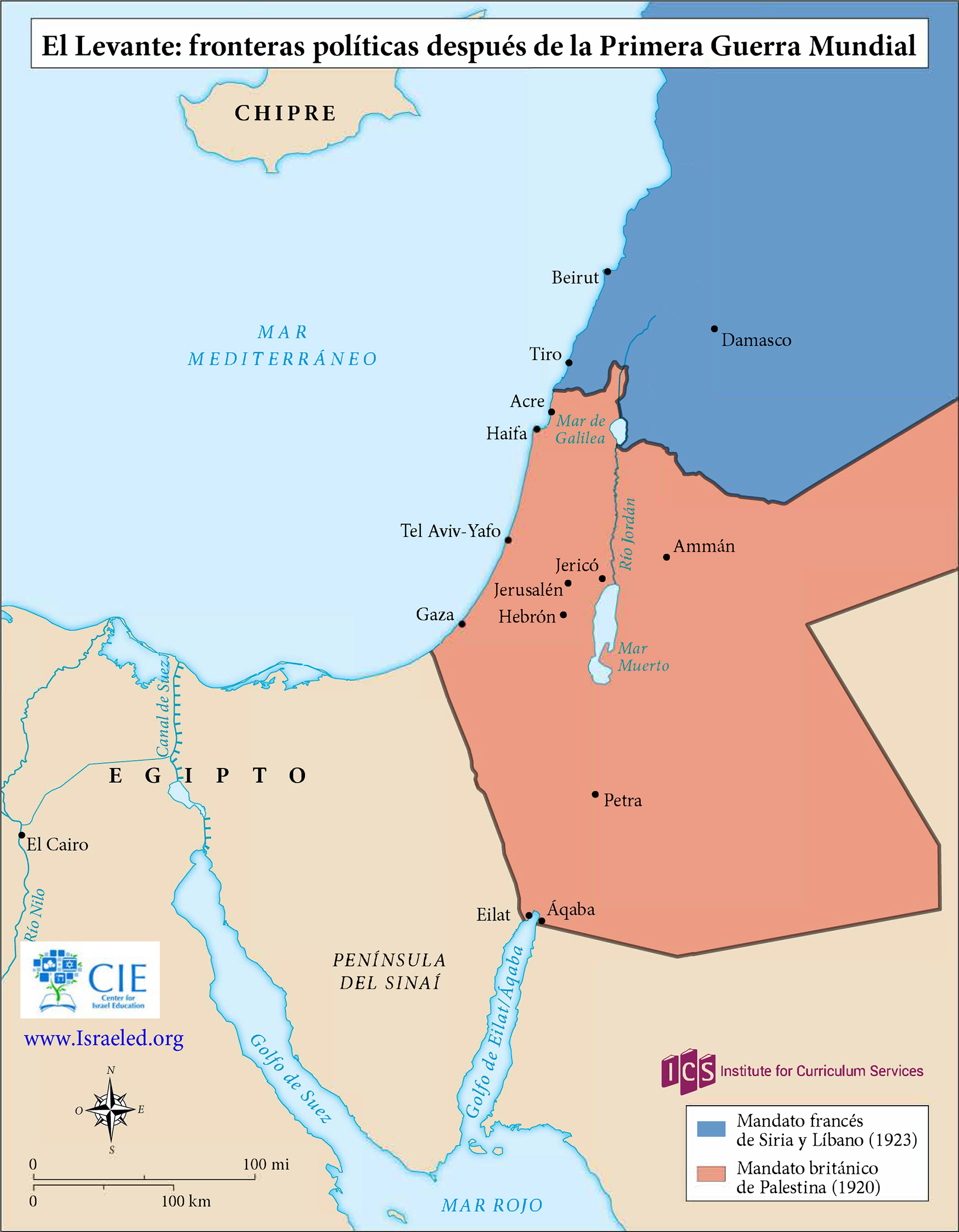
The British and French zones of influence, or mandates, in the eastern Mediterranean region were ratified by the San Remo Agreement in 1920 and approved by the League of Nations in 1922.
![]()
By Topic
Find content relevant to your specific interests or area of study.
By Type
Choose the format that best suits how you want to engage with the content.
By Language
Access content in the language that best supports your learning.
By Era
Explore content organized by historical period to focus your learning by timeframe.

The British and French zones of influence, or mandates, in the eastern Mediterranean region were ratified by the San Remo Agreement in 1920 and approved by the League of Nations in 1922.
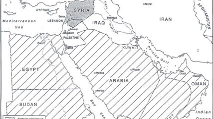
The European agreement that identified the states of the Middle East, 1920.
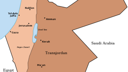
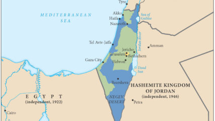
When Britain controlled Palestine, she lopped off 80% of it and assigned it to the Hashemite family leader, Emir Abdullah. It became today’s Hashemite Kingdom of Jordan.
The United Nations General Assembly approved Resolution 181 on Nov. 29, 1947, to divide the British Mandate of Palestine into an Arab state and a Jewish state along the lines in this map, with an international zone around Jerusalem.
We use cookies to understand how visitors use our site and to show relevant content across the web. You can accept everything, reject non-essential cookies, or customize your choices. Privacy policy.