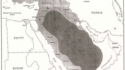
Map of the Middle East, Circa 1914CIE+
The region prior to the outbreak of World War I. After the war, modern Middle Eastern states had their borders arbitrarily drawn by European powers.
![]()
By Topic
Find content relevant to your specific interests or area of study.
By Type
Choose the format that best suits how you want to engage with the content.
By Language
Access content in the language that best supports your learning.
By Era
Explore content organized by historical period to focus your learning by timeframe.
The region prior to the outbreak of World War I. After the war, modern Middle Eastern states had their borders arbitrarily drawn by European powers.
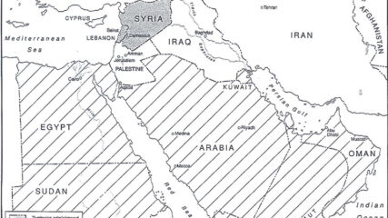
The European agreement that identified the states of the Middle East, 1920.
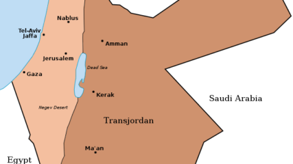
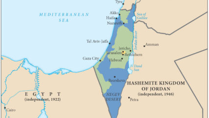
When Britain controlled Palestine, she lopped off 80% of it and assigned it to the Hashemite family leader, Emir Abdullah. It became today’s Hashemite Kingdom of Jordan.

A map shows the partition of Palestine proposed by the Peel Commission in 1937.
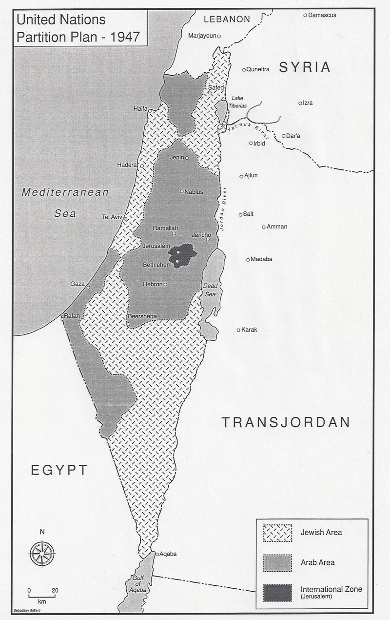
The UN suggested partition of Palestine into Arab and Jewish states with an economic union between them and an internationalization of Jerusalem.
The United Nations General Assembly approved Resolution 181 on Nov. 29, 1947, to divide the British Mandate of Palestine into an Arab state and a Jewish state along the lines in this map, with an international zone around Jerusalem.
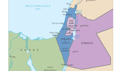
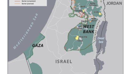
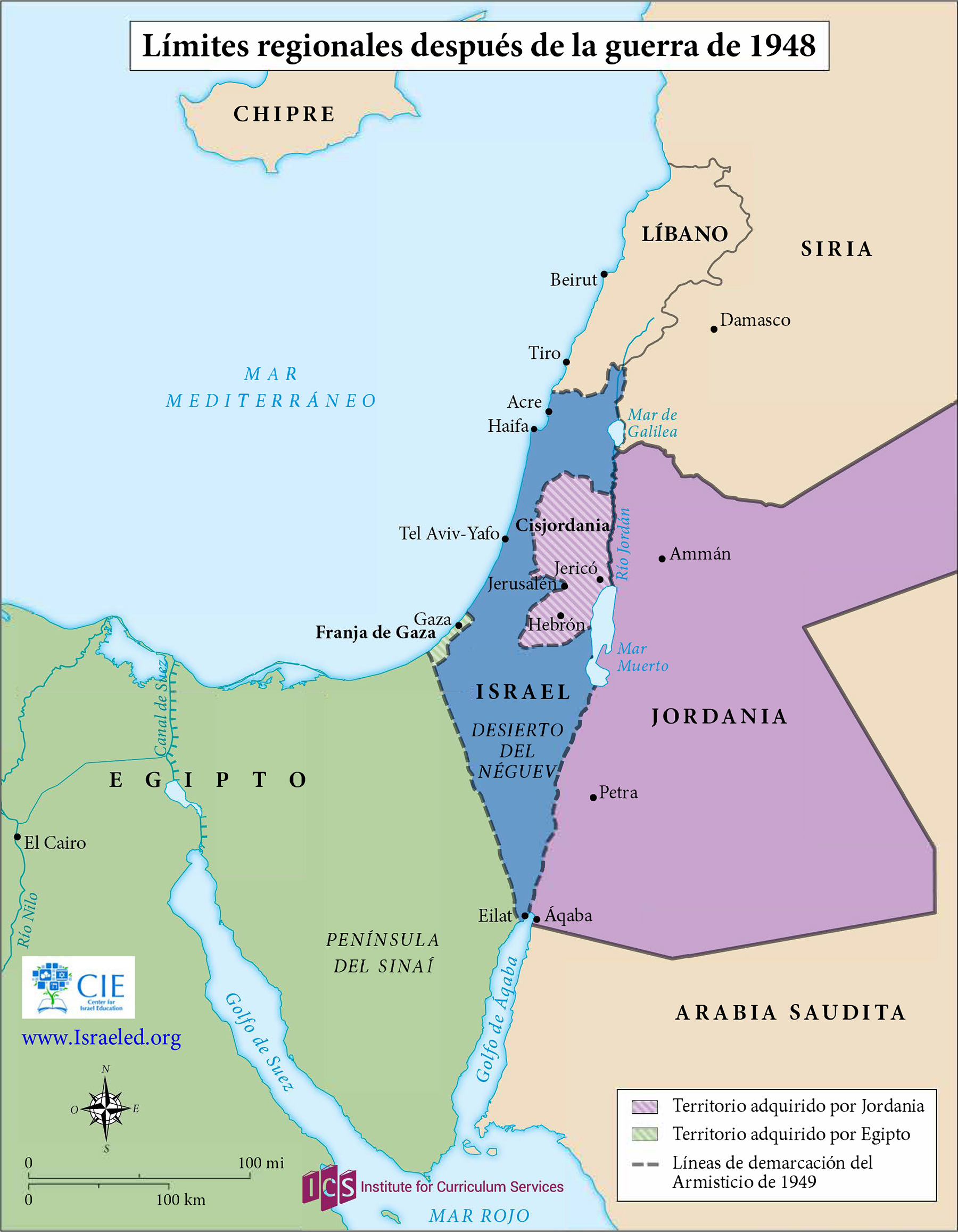
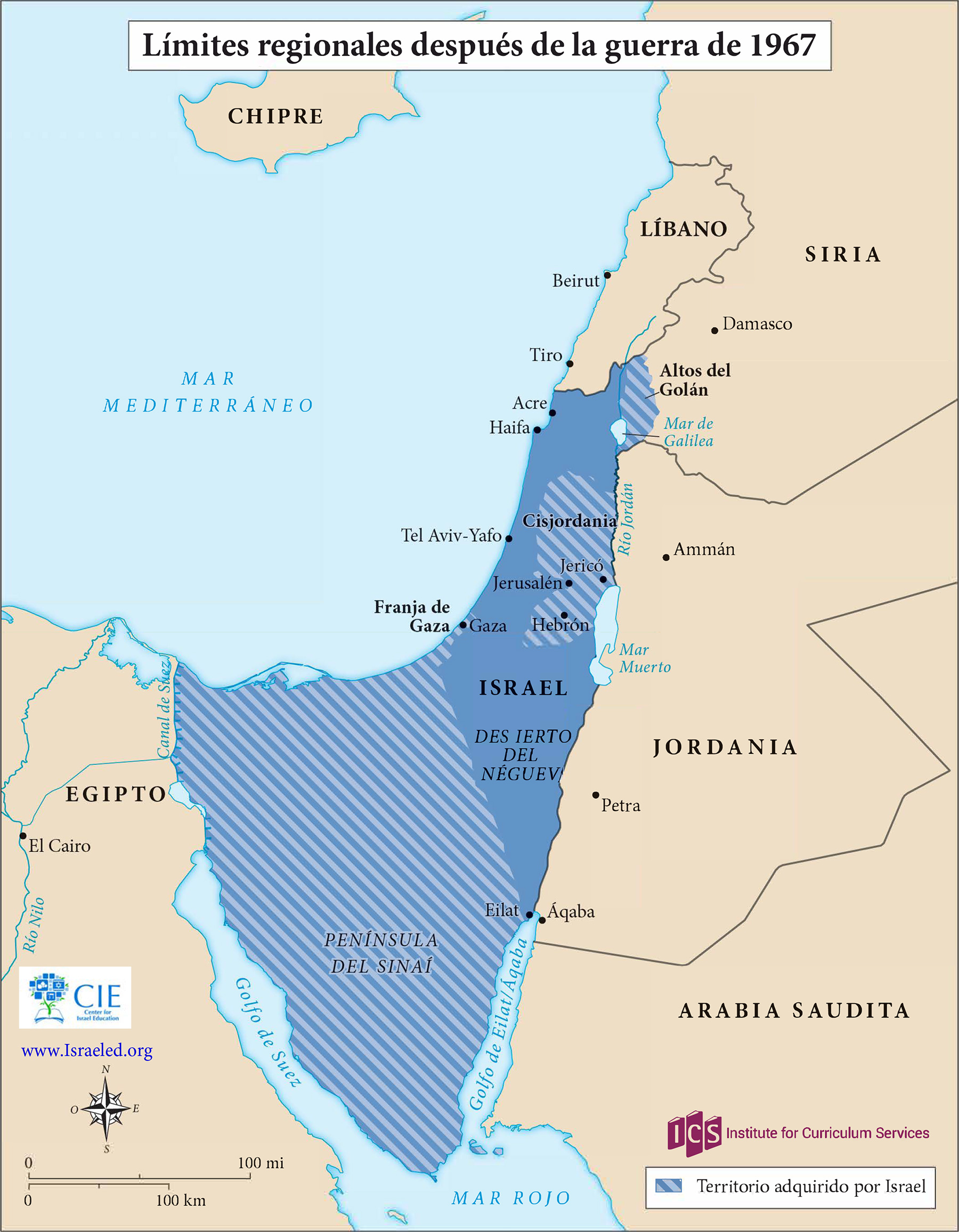
This map shows the territories controlled by Israel, Jordan (including the West Bank(, Lebanon, Syria and Egypt (including the Gaza Strip) at the end of Israel’s War of Independence in 1949. An Arab state was not created in Palestine. Jordan annexed the West Bank, and Egypt maintained administrative control of the Gaza Strip. Israel captured Gaza and the West Bank in the June 1967 war.
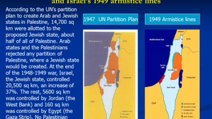
The area of Israel expanded and the potential area for a Palestinian Arab state decreased because of the 1948-49 war, Israel’s War of Independence. The Arab rejection of the 1947 U.N. partition plan thus hurt the Arab side, as the maps demonstrate.
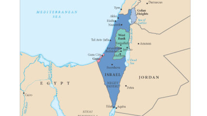
In the aftermath of the 1948 War of Independence, Israel signed armistice agreements with Egypt, Jordan, Syria, and Lebanon. These armistice lines lasted until the immediate aftermath of the June 1967 War. Israel has 1068 kilometers in land borders. Egypt 208 km, Gaza Strip 59 km, Jordan 307 km, Lebanon 81 km, Syria 83 km, and the West Bank 330 km; its Mediterranean coastline 273 km. CIA The World Factbook – Israel
With its six-day victory in the June 1967 war, Israel added the Sinai Peninsula, the Gaza Strip, the Golan Heights and the West Bank (Judaea and Samaria) to the territory under its control. Israelis moved into all of those areas over the next decade.

As a result of the June 1967 War, Israel increased its size seven fold to include Eastern Jerusalem, the Golan Heights, the West Bank of the Jordan River, and the Gaza Strip.

Drafted by Minister of Labor Yigal Allon after the June 1967 war, the plan envisages Israeli retention of a series of settlements and military installations along the Jordan Valley as buffers to a potential Arab land attack from the east.
For Sadat, who had gone to war against Israel three months earlier, securing a military disengagement agreement was important. In addition, diplomatically engaging the US to secure the agreement meant entrenching Washington as a friend of Egypt. The US embraced the opportunity to quell tensions between Israel and Egypt, while squiring Cairo away from decades of Moscow’s embrace. Israel had its POWs returned and slowly tested Sadat’s broader intentions toward Jerusalem.
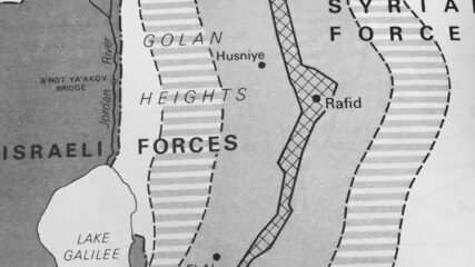
In the last days of the June 1967 War Israel secured a portion of the Syrian Golan Heights, estimated at 1300 sq km or 500 sq mi; Israel forces sit some 40 miles, 60km from Damascus. Before the June War, Israeli villages and populations in the valley were fired upon by Syrian forces from the Heights. In addition to being an important catchment for Jordan River waters which helps supply Israel’s water needs, the heights contain not fully explored hydrocarbon sources. In the northern Heights is Mt. Hermon which has strategic value for observing military movements into southern Lebanon and to Damascus.
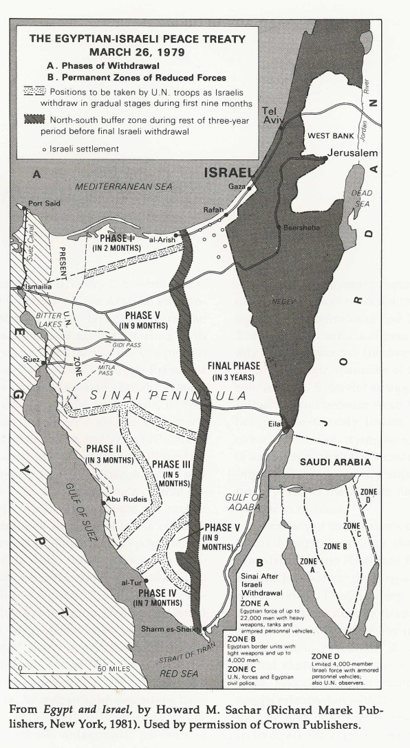
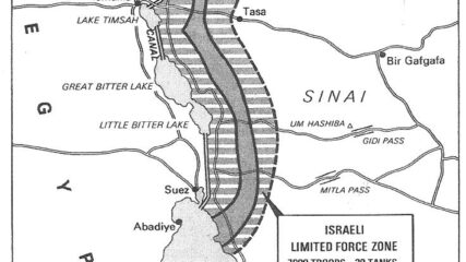
To test Egypt’s intentions, Israel took eight years, from January 1974 to April 1982, to withdraw from virtually all of Sinai.

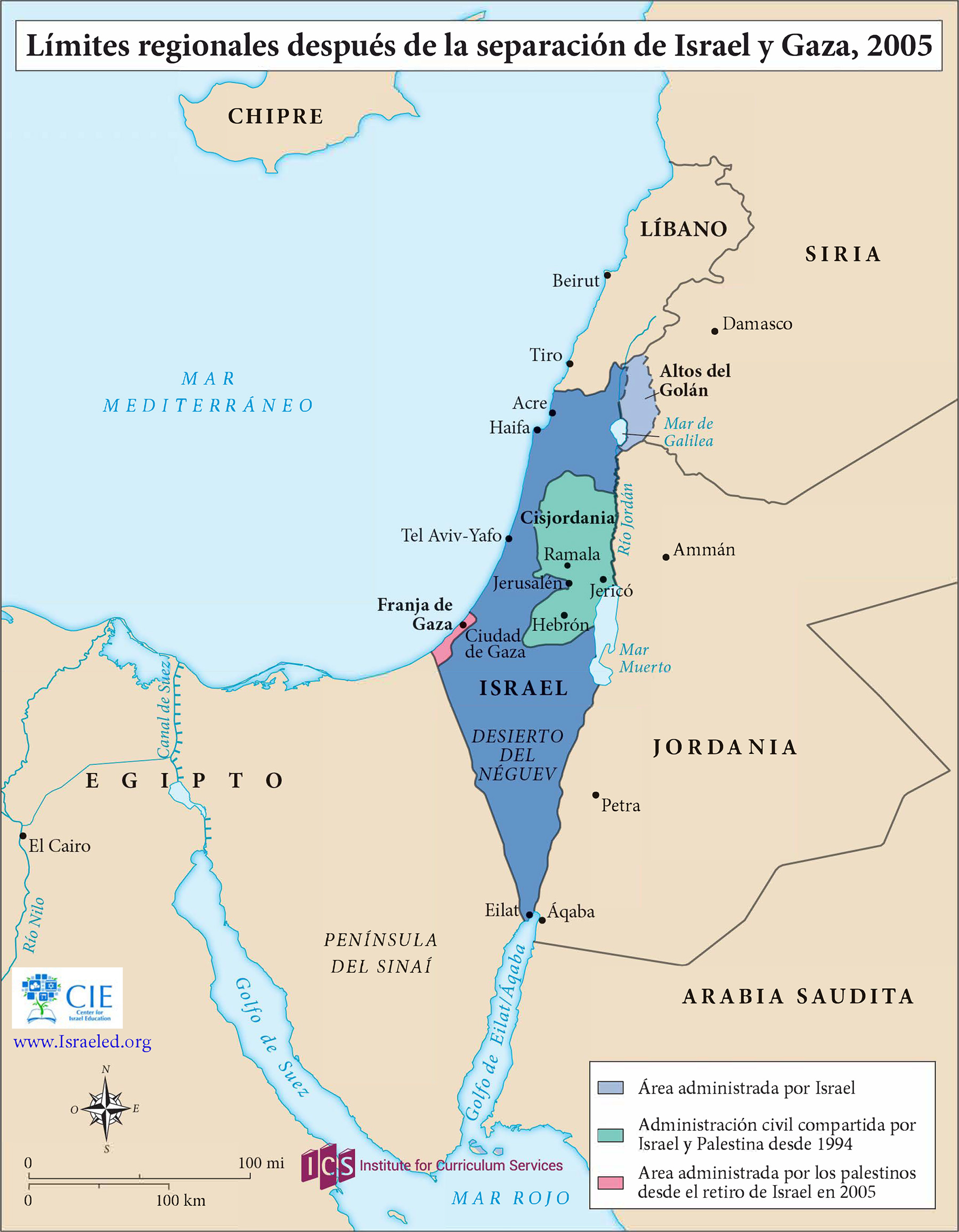
Under the 1979 peace treaty, Israel withdrew completely from the Sinai, abandoning settlements and oil fields, by 1982. But Egypt did not reclaim the Gaza Strip, which it had controlled from 1948 to 1967.
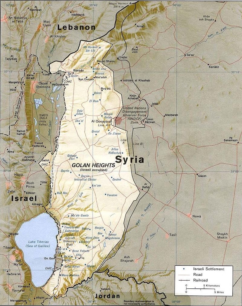
After Israel secured the Golan Heights in the June 1967 War, the Israeli government offered to negotiate its return, some 1300 km, for a peace treaty with Israel. Israel withdrew from a small portion of the Heights after the 1973 War. It continued to build Israeli settlements in strategic locations and in 1981 applied Israeli law to the area. Some 20,000 Israelis live there in 32 settlements, along with 20,000 Druze.
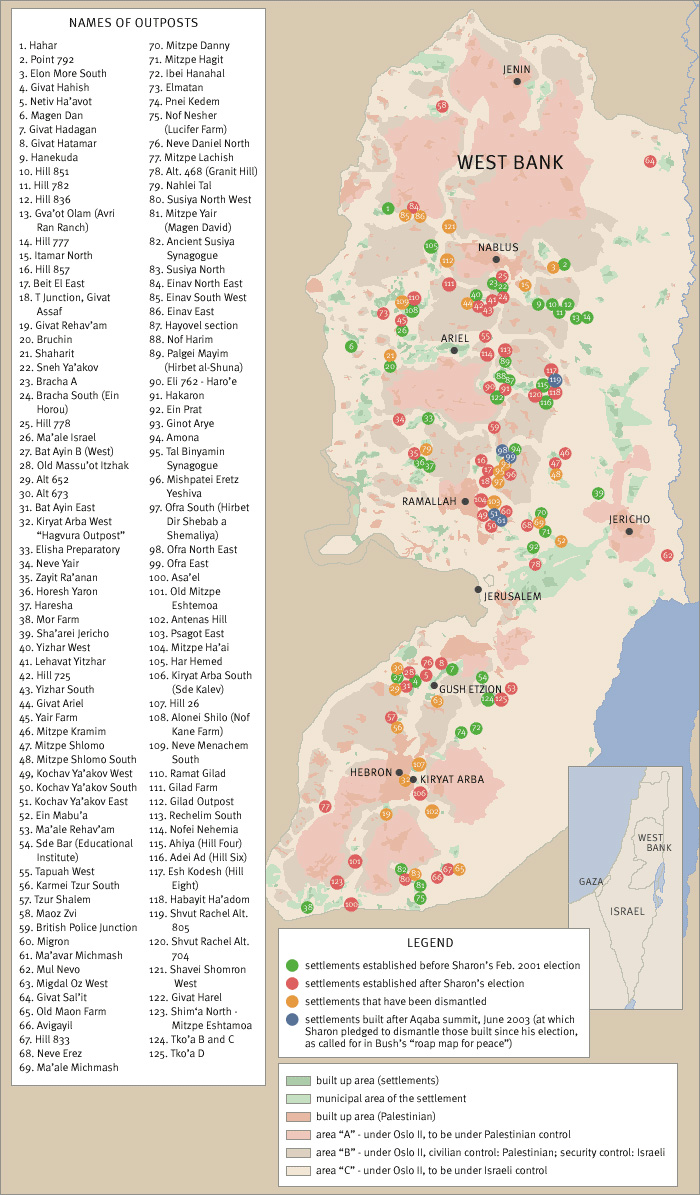
As an unintended consequence of the June 1967 War, Israel found itself controlling the entire West Bank of the Jordan River, amounting to 2,300 square miles with 680,000 Palestinian living in 396 villages, towns and in portions of Jerusalem. From 1976 forward, the US and the international community in general have labelled the settlements as either“illegal” or as an “obstacle to peace.” The growth of the settlements or their expansion has occurred in a spatial manner that places Israeli settler populations in between Arab villages and towns in order to limit or prevent Arab contiguity in the West Bank.
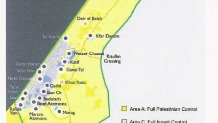
From 1977 to 1979, the settler population in the territories grew from 3,200 to 17,500, plus 80,000 in East Jerusalem. Of the 225,000 Israel settlers in the “territories” in 2005, all 8,500 settlers living in Gaza (5% of the total) were evacuated with the area turned over to the Palestinian Authority. In 2006, Hamas won Palestinian legislative elections, and in 2007 the terrorist group conducted a coup and ousted the Palestinian Authority from Gaza.
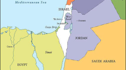
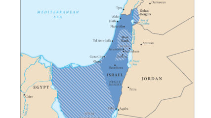
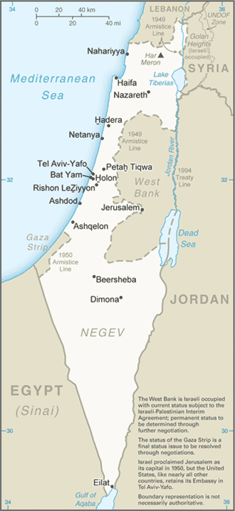
This regional map shows Israel and its neighbors after the Israeli withdrawal from the Sinai Peninsula, completed in 1982, and the disengagement from the Gaza Strip in August 2005.
This map shows the State of Palestine as proposed by the Trump plan with features and selected locations from the Washington Institute Settlements and Solutions website.
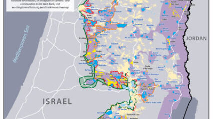
Israeli prime minister Binyamin Netanyahu has repeatedly declared that he will be putting forward his proposal for West Bank annexation as early as July 1. Yet uncertainties about his plans still abound, indicating that this timetable may not be met despite his assertions to the contrary.
Courtesy of the University of Texas, Map Collection, https://maps.lib.utexas.edu/maps/
We use cookies to understand how visitors use our site and to show relevant content across the web. You can accept everything, reject non-essential cookies, or customize your choices. Privacy policy.