Map of Peel (Partition) Report for Arab and Jewish States, 1937CIE+
A map shows the partition of Palestine proposed by the Peel Commission in 1937.
![]()
By Topic
Find content relevant to your specific interests or area of study.
By Type
Choose the format that best suits how you want to engage with the content.
By Language
Access content in the language that best supports your learning.
By Era
Explore content organized by historical period to focus your learning by timeframe.

A map shows the partition of Palestine proposed by the Peel Commission in 1937.
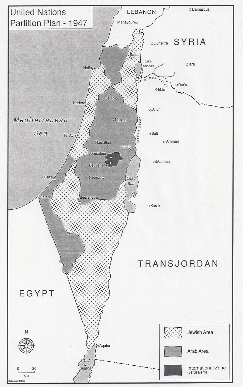
The UN suggested partition of Palestine into Arab and Jewish states with an economic union between them and an internationalization of Jerusalem.
The United Nations General Assembly approved Resolution 181 on Nov. 29, 1947, to divide the British Mandate of Palestine into an Arab state and a Jewish state along the lines in this map, with an international zone around Jerusalem.
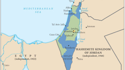
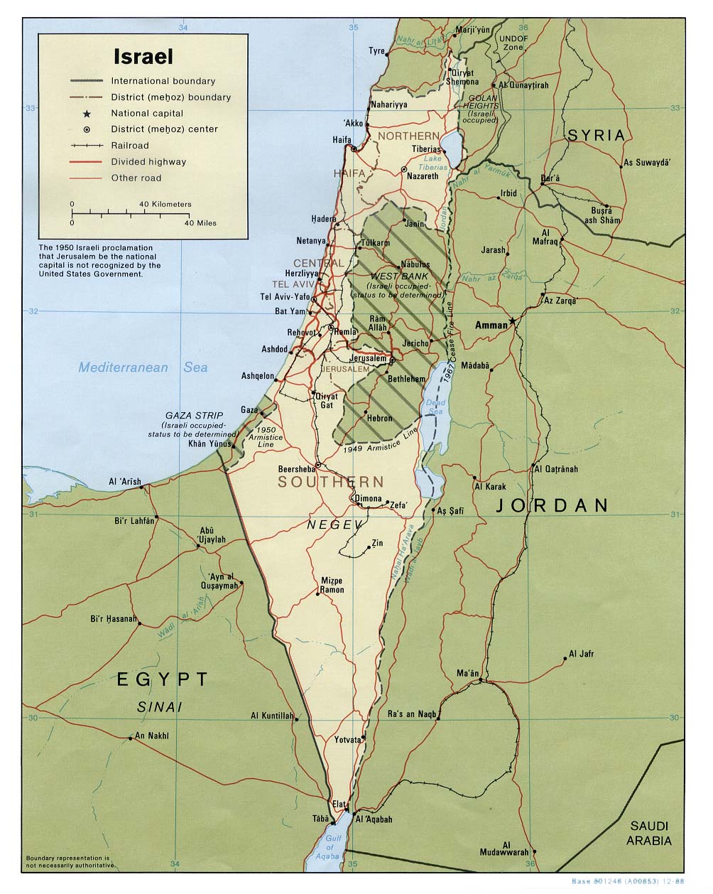
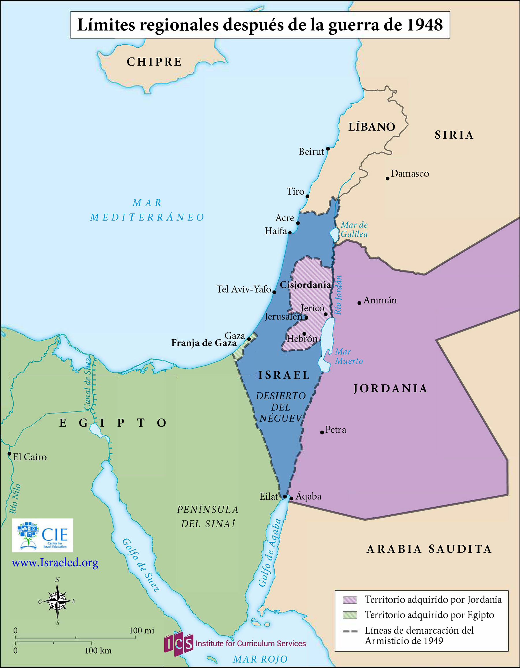
This map shows the territories controlled by Israel, Jordan (including the West Bank(, Lebanon, Syria and Egypt (including the Gaza Strip) at the end of Israel’s War of Independence in 1949. An Arab state was not created in Palestine. Jordan annexed the West Bank, and Egypt maintained administrative control of the Gaza Strip. Israel captured Gaza and the West Bank in the June 1967 war.
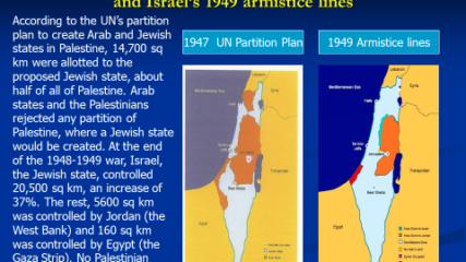
The area of Israel expanded and the potential area for a Palestinian Arab state decreased because of the 1948-49 war, Israel’s War of Independence. The Arab rejection of the 1947 U.N. partition plan thus hurt the Arab side, as the maps demonstrate.
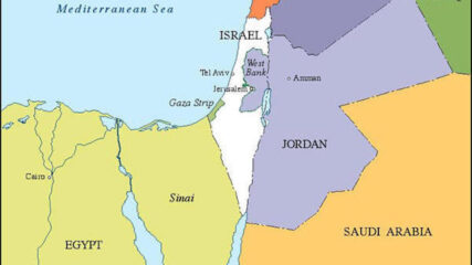
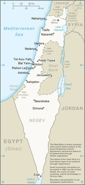
In the aftermath of the 1948 War of Independence, Israel signed armistice agreements with Egypt, Jordan, Syria, and Lebanon. These armistice lines lasted until the immediate aftermath of the June 1967 War. Israel has 1068 kilometers in land borders. Egypt 208 km, Gaza Strip 59 km, Jordan 307 km, Lebanon 81 km, Syria 83 km, and the West Bank 330 km; its Mediterranean coastline 273 km. CIA The World Factbook – Israel

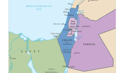
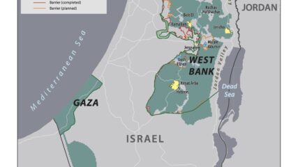
As a result of the June 1967 War, Israel increased its size seven fold to include Eastern Jerusalem, the Golan Heights, the West Bank of the Jordan River, and the Gaza Strip.

The Old City of Jerusalem is divided into four religious quarters: Armenian, Christian, Jewish and Muslim areas. The overall population of the Old City is 34,000, 11 percent of whom are Jews. Jews account for 59 percent of the population of the Old City’s Jewish Quarter and 49 percent of the Armenian Quarter.
This map shows the State of Palestine as proposed by the Trump plan with features and selected locations from the Washington Institute Settlements and Solutions website.
Courtesy of the University of Texas, Map Collection, https://maps.lib.utexas.edu/maps/
We use cookies to understand how visitors use our site and to show relevant content across the web. You can accept everything, reject non-essential cookies, or customize your choices. Privacy policy.
