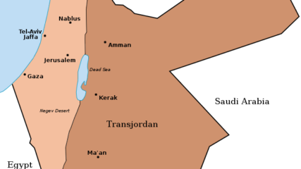
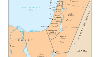
Map of Palestine and Transjordan, 1922CIE+
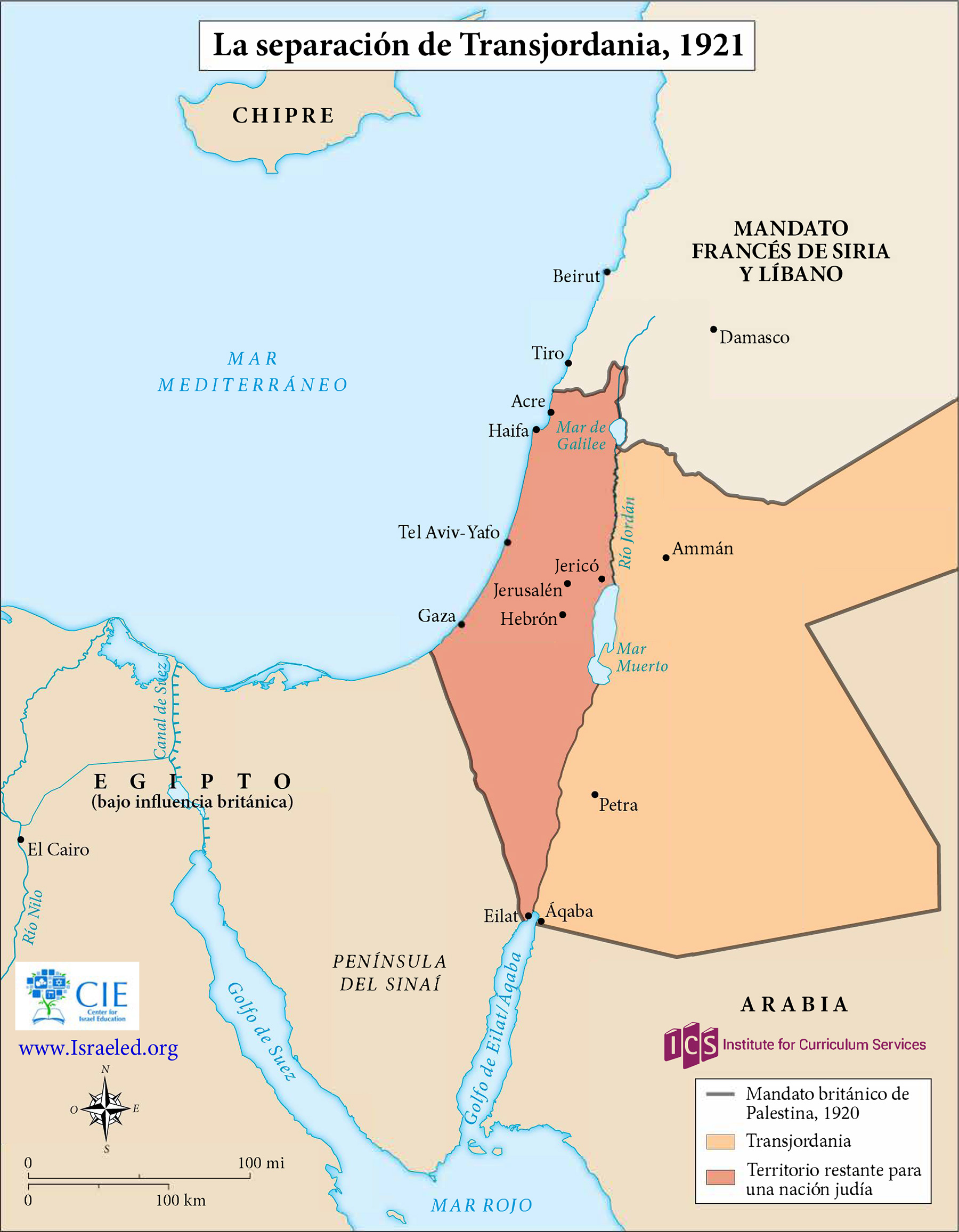
When Britain controlled Palestine, she lopped off 80% of it and assigned it to the Hashemite family leader, Emir Abdullah. It became today’s Hashemite Kingdom of Jordan.
![]()
When Britain controlled Palestine, she lopped off 80% of it and assigned it to the Hashemite family leader, Emir Abdullah. It became today’s Hashemite Kingdom of Jordan.
As shown in this map, the British in 1921 separated a new emirate, Transjordan, from what officially became the Mandate for Palestine the next year. The British officially maintained political and military control of both…
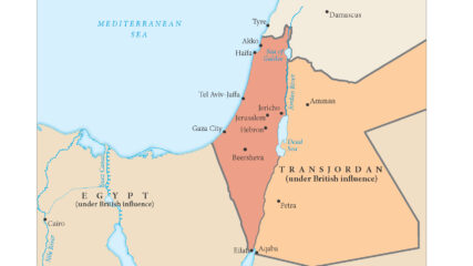
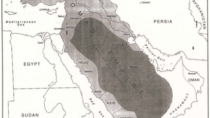
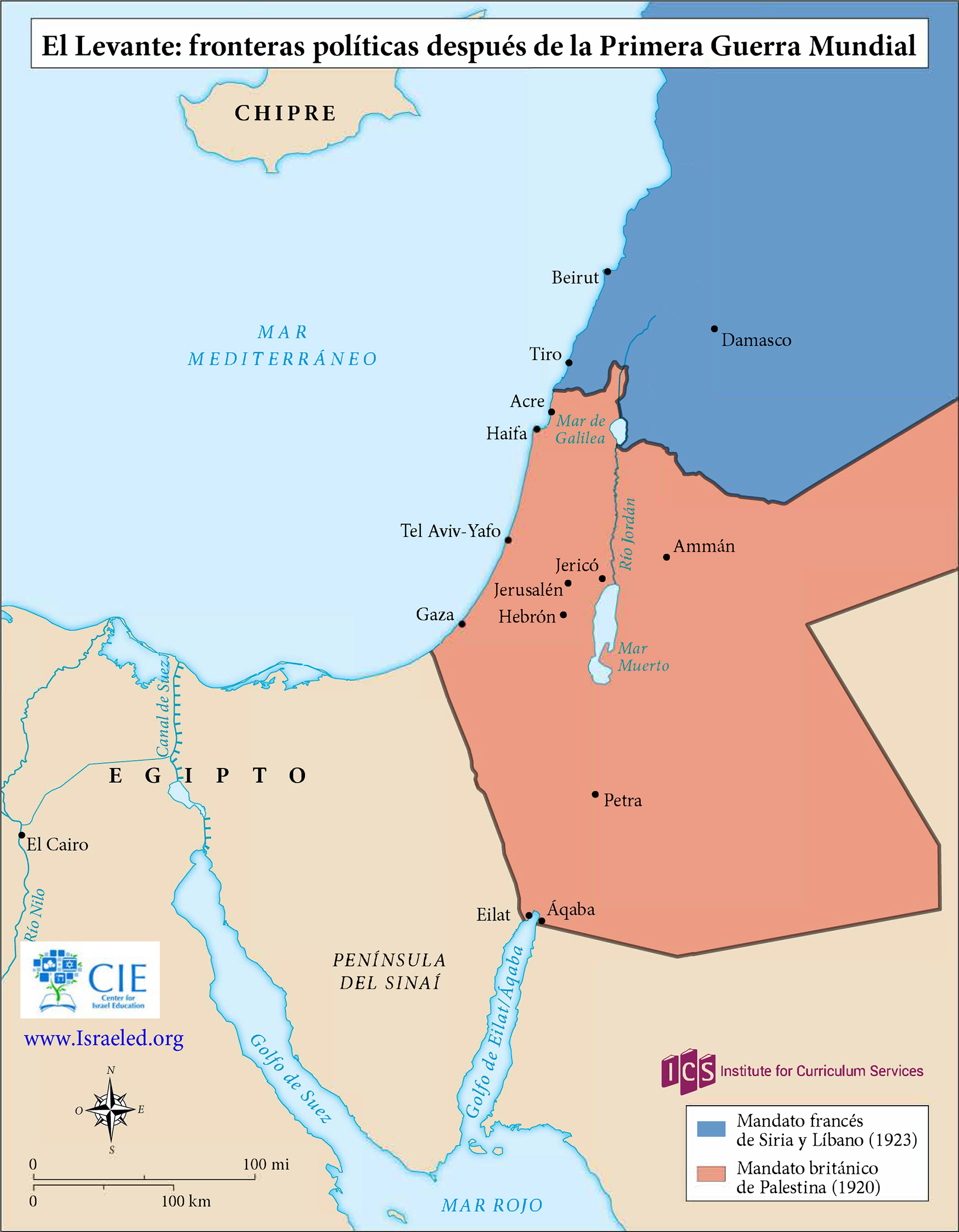
The European agreement that identified the states of the Middle East, 1920.

The British and French zones of influence, or mandates, in the eastern Mediterranean region were ratified by the San Remo Agreement in 1920 and approved by the League of Nations in 1922.
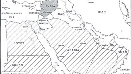
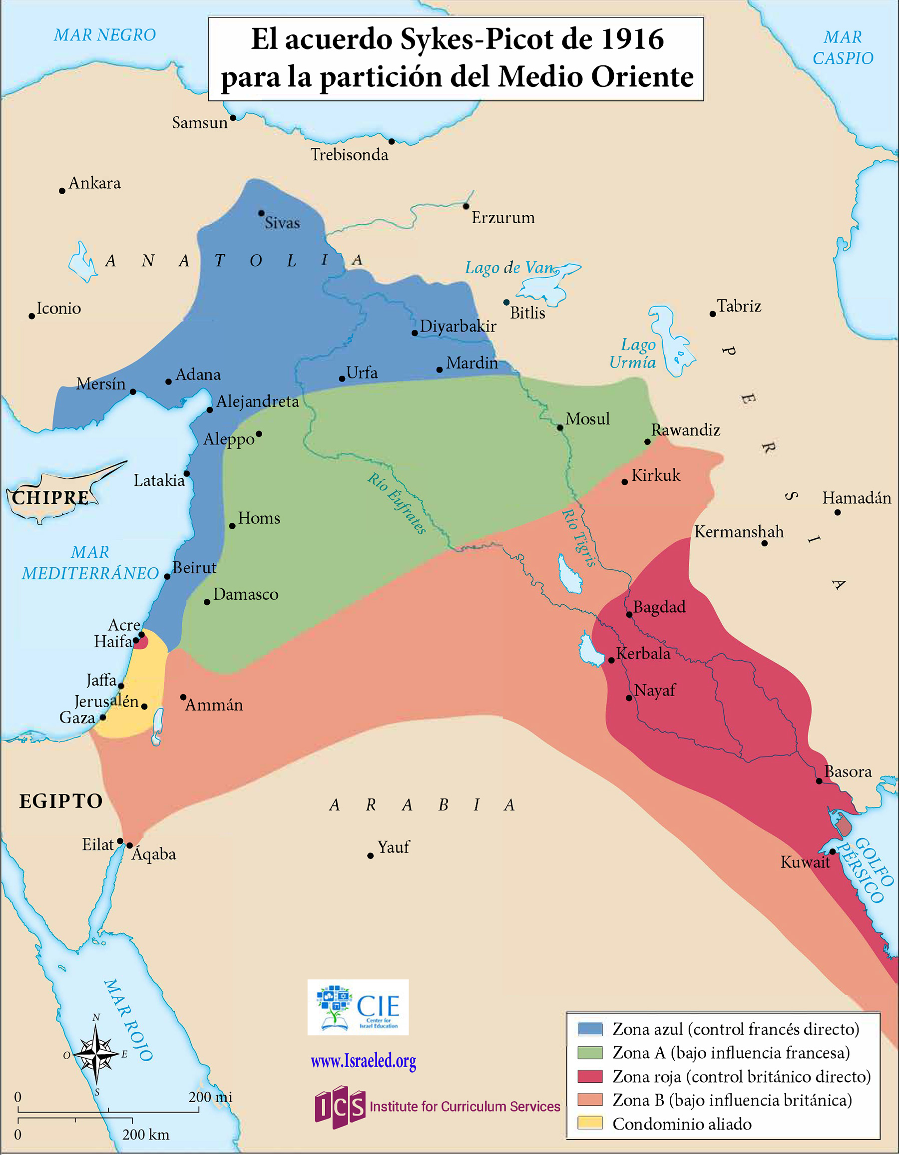
Great Britain and France secretly negotiated the Sykes-Picot Agreement in 1916. The two European powers agreed, according to their respective spheres of influence, to divide the Middle East territories previously administered by the Ottoman Empire.
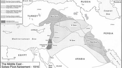
A map showing the Russian-French-English secret agreement that carved up the Middle East into future areas of interest.
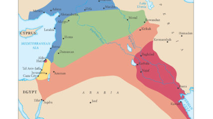
This map shows the Ottoman Empire’s administrative districts before World War I broke out in August 1914 in areas that today are Israel, Gaza, the West Bank, Lebanon, Jordan, Syria and part of Iraq.
The region prior to the outbreak of World War I. After the war, modern Middle Eastern states had their borders arbitrarily drawn by European powers.
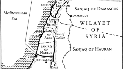
The area of Eretz Yisrael was part of the Ottoman Empire and composed of three large administrative areas without any political identity as a state or part of a state. At times, portions of the area that was later designated as the Palestine Mandate were ruled from Mecca, Damascus, or Baghdad, or in the case of Jerusalem, directly from Istanbul.
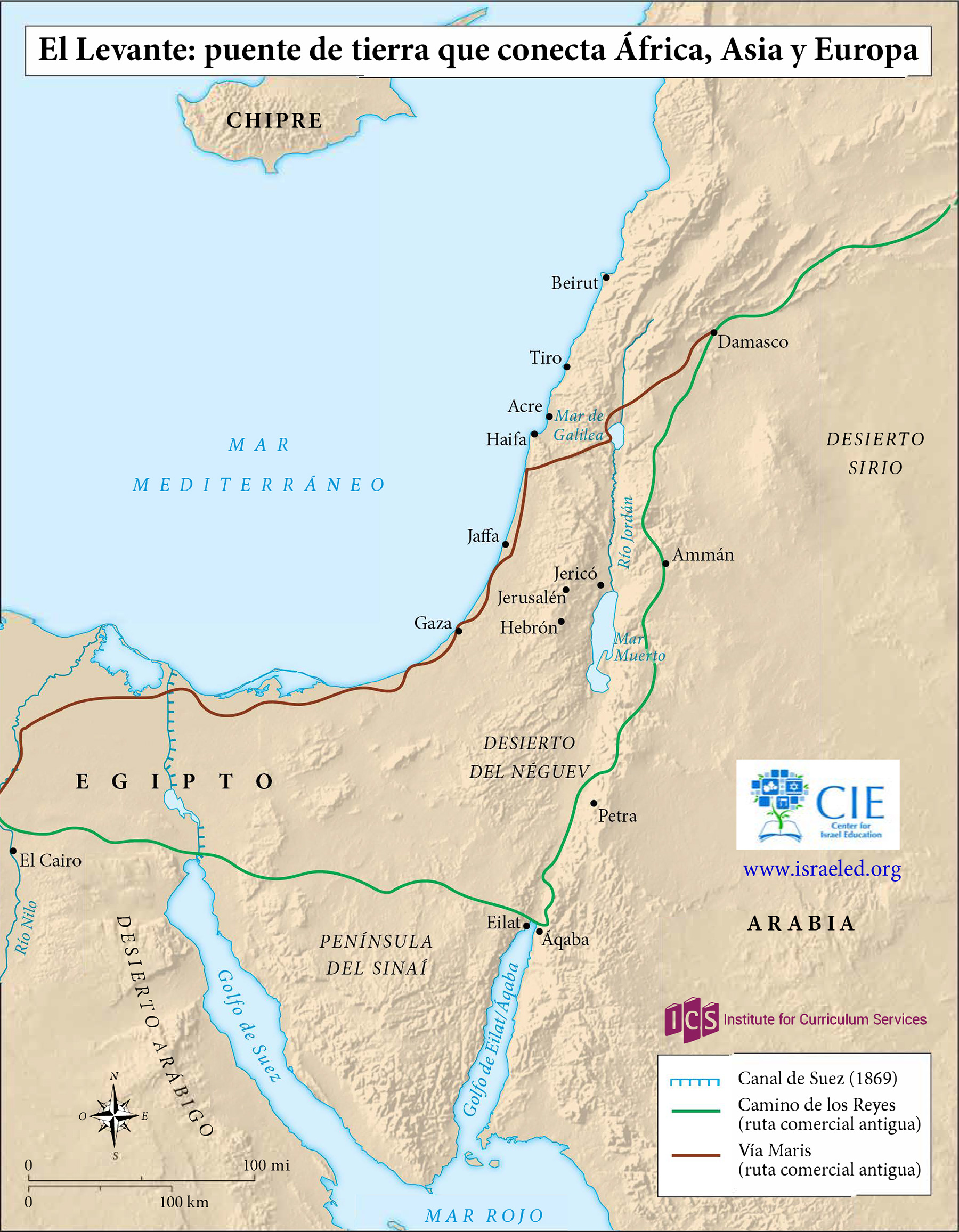
This map shows the Levant, including the Land of Israel, which serves as a bridge linking Africa, Asia and Europe. The map shows ancient trade routes but not political borders before or after World War…

April 8, 1960 U.N. Secretary-General Dag Hammarskjold for the first time publicly criticizes Egypt’s confiscation of Israeli cargo on ships going through the Suez Canal. The Egyptian closure of the Straits of Tiran and the…
September 26, 1955 Oil is discovered in Heletz, a moshav in southern Israel that becomes the site of the state’s first successful oil well. The Heletz field, containing an estimated 94.4 million barrels of oil,…
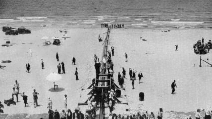
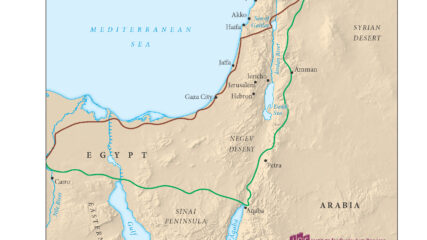
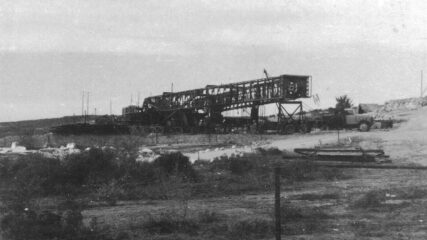
The Mosul-Haifa pipeline, which spans 590 miles, connects the Mosul oil fields and the Mediterranean Sea. It begins in Kirkuk, Iraq and ends in Haifa.
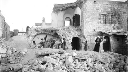
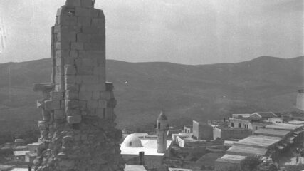
July 11, 1927 A major earthquake strikes Jericho just after 3 p.m., killing between 300 and 500 people and injuring at least 700 others. Measured at a magnitude of 6.3, the quake lasts about five…

March 1, 1920 A Shi’ite Arab militia, accompanied by local Bedouins, attacks the Jewish agricultural settlement of Tel Hai, which has served as a border outpost in the Upper Galilee between British-controlled Palestine and French-controlled…
A massive earthquake and subsequent landslide devastate Jewish and Arab communities in Safed (Tz’fat). The mountain town, which had been the long-time home to a thriving Jewish population, suffers thousands of deaths.