Map of Egyptian-Israeli Peace Treaty, March 1979CIE+
To test Egypt’s intentions, Israel took eight years, from January 1974 to April 1982, to withdraw from virtually all of Sinai.
![]()
By Topic
Find content relevant to your specific interests or area of study.
By Type
Choose the format that best suits how you want to engage with the content.
By Language
Access content in the language that best supports your learning.
By Era
Explore content organized by historical period to focus your learning by timeframe.
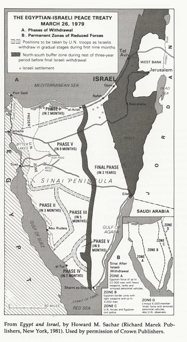
To test Egypt’s intentions, Israel took eight years, from January 1974 to April 1982, to withdraw from virtually all of Sinai.

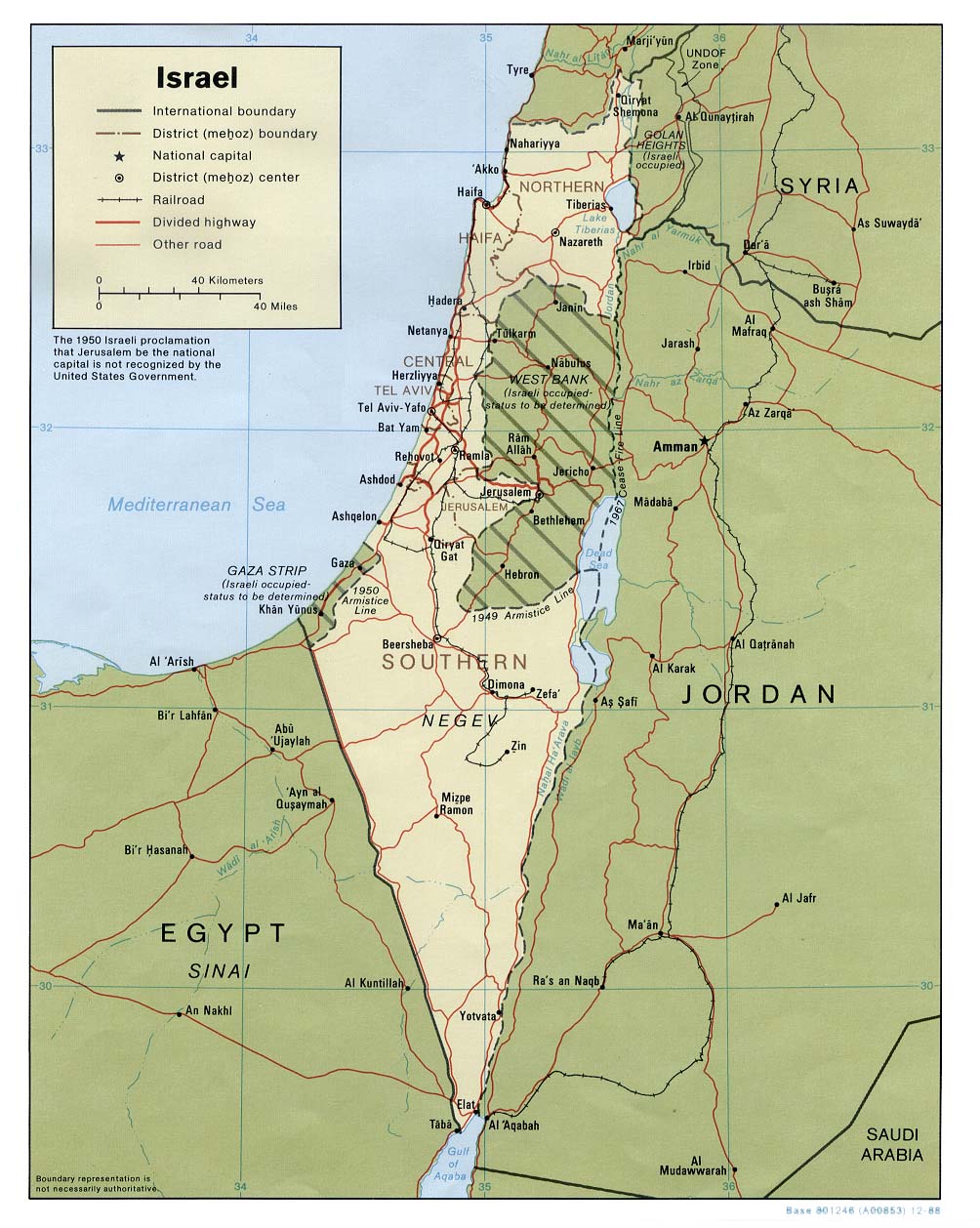
The Old City of Jerusalem is divided into four religious quarters: Armenian, Christian, Jewish and Muslim areas. The overall population of the Old City is 34,000, 11 percent of whom are Jews. Jews account for 59 percent of the population of the Old City’s Jewish Quarter and 49 percent of the Armenian Quarter.
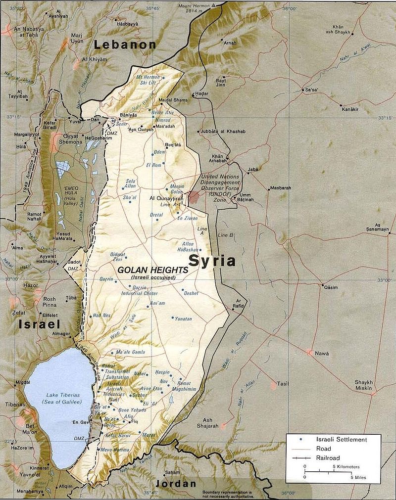
After Israel secured the Golan Heights in the June 1967 War, the Israeli government offered to negotiate its return, some 1300 km, for a peace treaty with Israel. Israel withdrew from a small portion of the Heights after the 1973 War. It continued to build Israeli settlements in strategic locations and in 1981 applied Israeli law to the area. Some 20,000 Israelis live there in 32 settlements, along with 20,000 Druze.
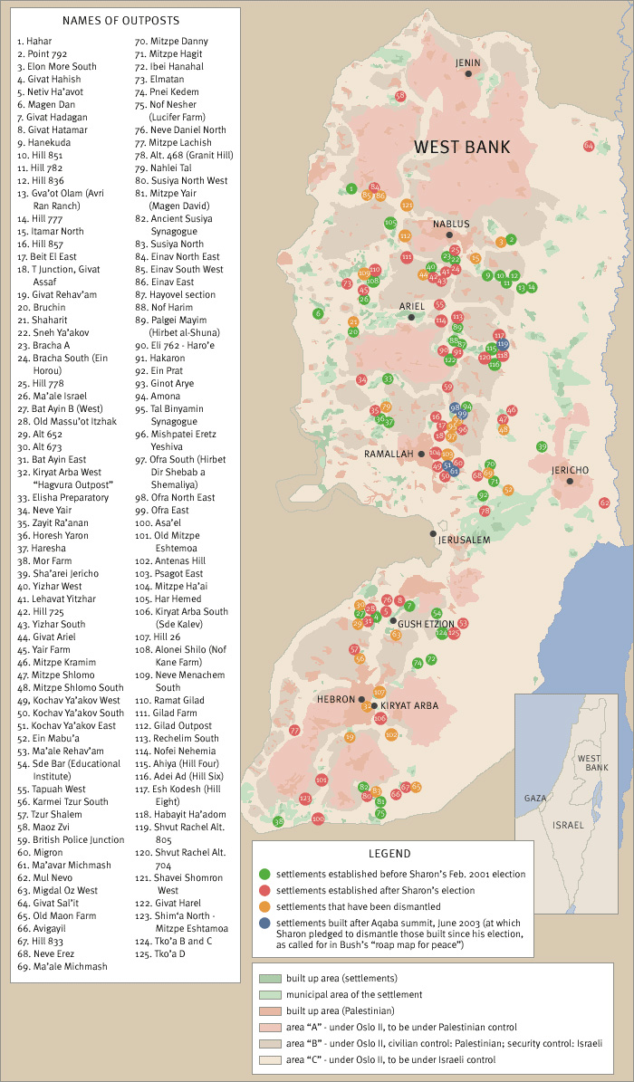
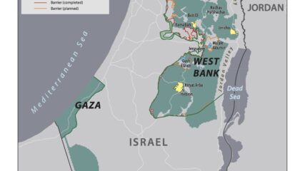
As an unintended consequence of the June 1967 War, Israel found itself controlling the entire West Bank of the Jordan River, amounting to 2,300 square miles with 680,000 Palestinian living in 396 villages, towns and in portions of Jerusalem. From 1976 forward, the US and the international community in general have labelled the settlements as either“illegal” or as an “obstacle to peace.” The growth of the settlements or their expansion has occurred in a spatial manner that places Israeli settler populations in between Arab villages and towns in order to limit or prevent Arab contiguity in the West Bank.
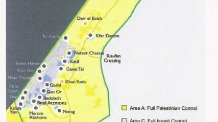
From 1977 to 1979, the settler population in the territories grew from 3,200 to 17,500, plus 80,000 in East Jerusalem. Of the 225,000 Israel settlers in the “territories” in 2005, all 8,500 settlers living in Gaza (5% of the total) were evacuated with the area turned over to the Palestinian Authority. In 2006, Hamas won Palestinian legislative elections, and in 2007 the terrorist group conducted a coup and ousted the Palestinian Authority from Gaza.
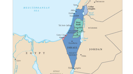
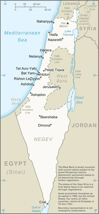
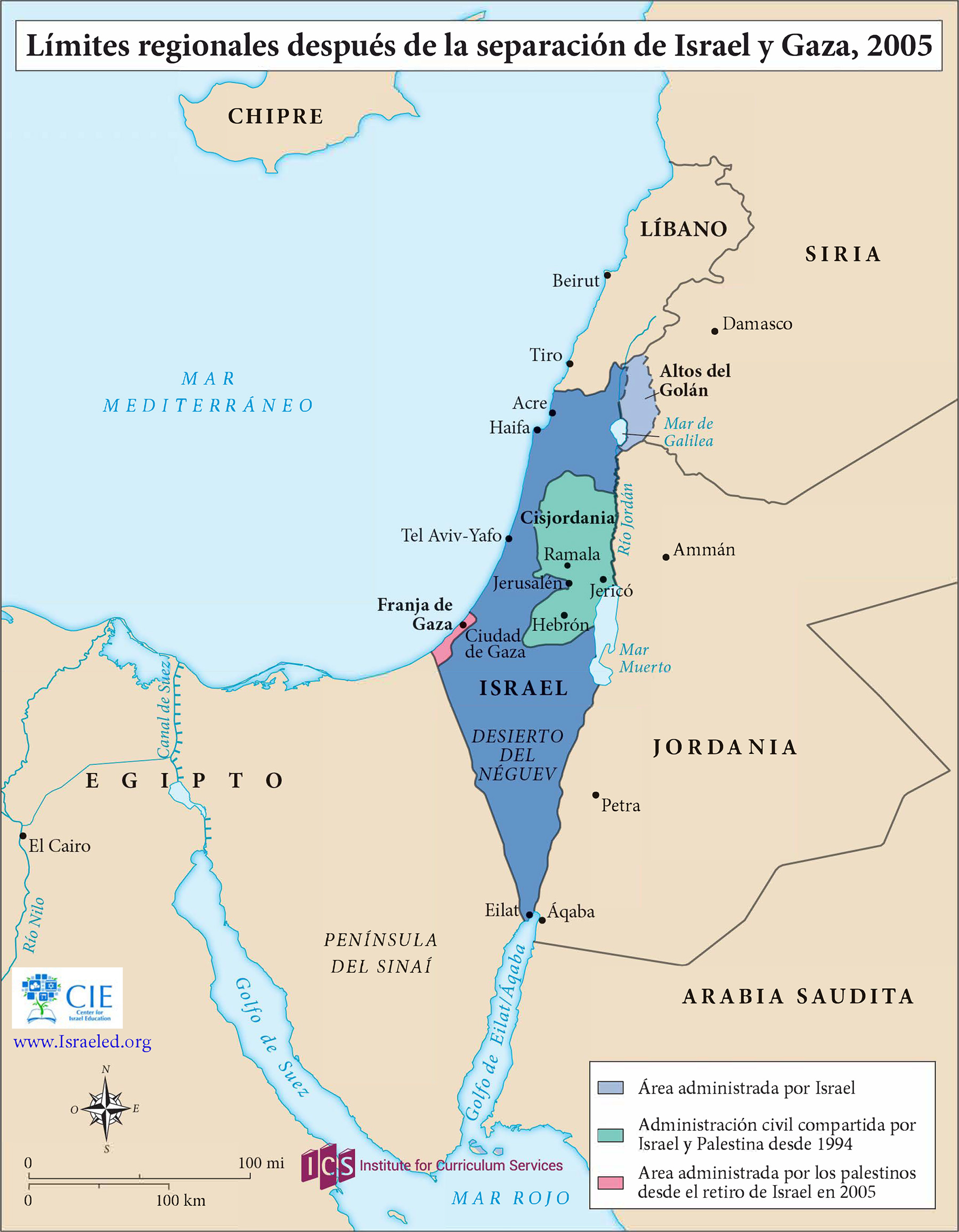
This regional map shows Israel and its neighbors after the Israeli withdrawal from the Sinai Peninsula, completed in 1982, and the disengagement from the Gaza Strip in August 2005.
This map shows the State of Palestine as proposed by the Trump plan with features and selected locations from the Washington Institute Settlements and Solutions website.

Maps of the Gaza Strip, Israel’s villages and kibbutzim around the Gaza Strip, former Israeli settlements there, and Israel’s requested zone of civilian withdrawal 10.14.2023
Courtesy of the University of Texas, Map Collection, https://maps.lib.utexas.edu/maps/
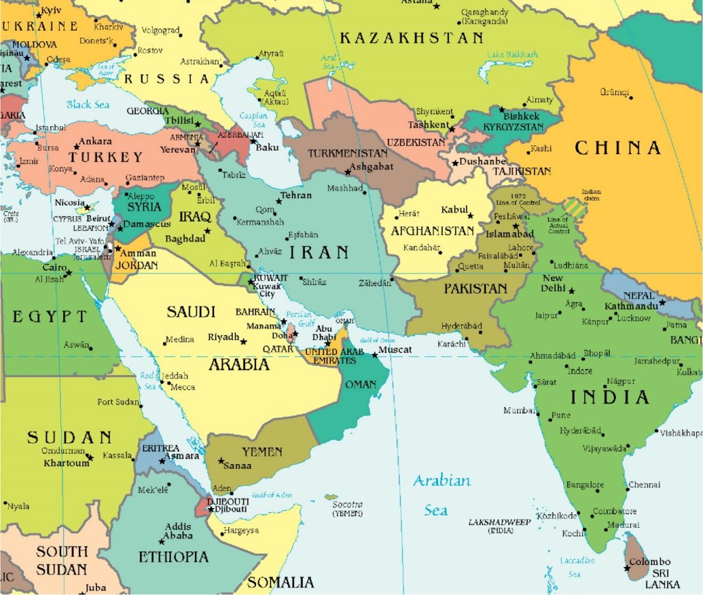
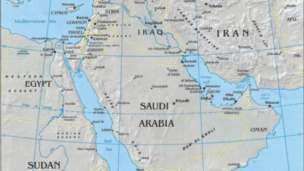
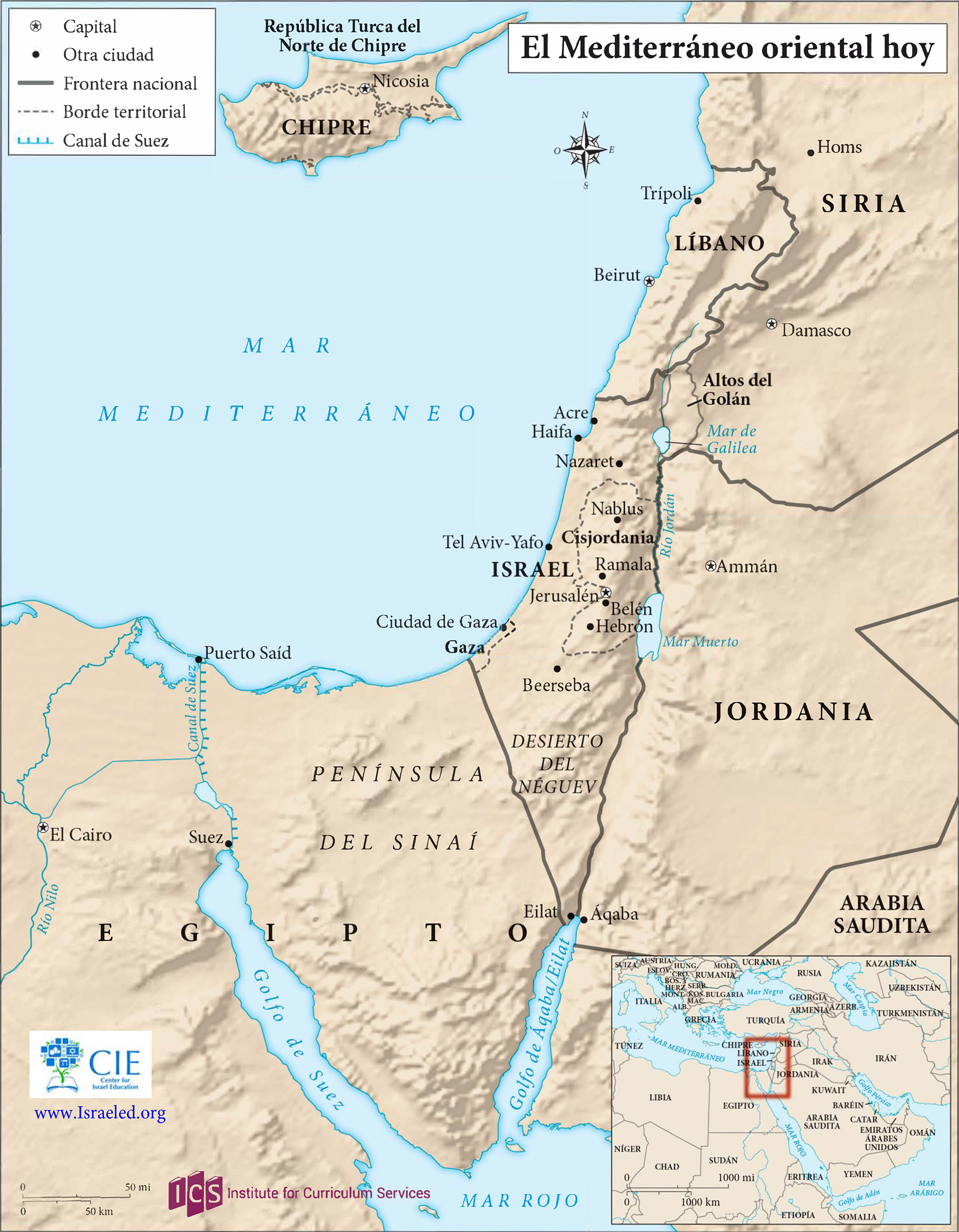
This 2018 map of the eastern Mediterranean, which remains current, shows all of Israel, Gaza, the West Bank, Lebanon and Cyprus, plus parts of Syria, Jordan, Egypt and Saudi Arabia, within the context of the Middle East as a whole.
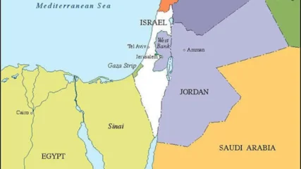
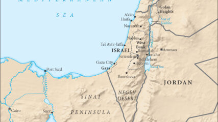
A current map showing the political borders of Israel and its nearest neighbors in the Arab world.
