FILTERED BY:

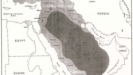
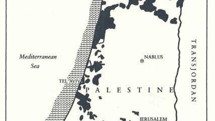
The land issue both originated and resides as one of the core issues in the Israeli-Palestinian conflict. The Middle East lands that were formerly under the control of the Ottoman Empire were allocated at the end of World War I based on European agreements and promises, resulting in questions about who should receive what and who would govern. What seems apparent from the 1939 British White Paper is that Palestine was to be excluded from the area set aside for Arab independence after World War I. Meanwhile, Zionists acquired the land to form the nucleus for a state by 1939. Arabs willingly sold land to Zionists from the 1890s through 1948. The evidence provided from Arabic newspapers and from British and Zionist sources shows a regular stream of sales to Jewish buyers, not merely from Arabs who lived outside of Palestine, but likewise from Arabs within Palestine.

The Key Curated Essentials for Land

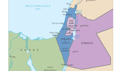
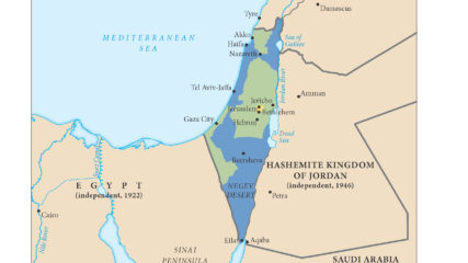
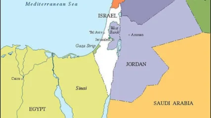
Map of Israel’s 1949 Borders

This map shows the territories controlled by Israel, Jordan (including the West Bank(, Lebanon, Syria and Egypt (including the Gaza Strip) at the end of Israel’s War of Independence in 1949. An Arab state was…

Maps|February 24, 1949|Spanish

Israel and the Jewish Nation: Part 1

E-book

Covering the foundations of Judaism and the history of the Jewish people, the unit starts with the ‘covenants’ and ends in 1897. It traces the Jewish connection to the land of Israel, in the land and in exile. It explains how and why Jews retained their traditions in the face of enormous challenges. It concludes with the birth of Zionism as one answer to Jewish insecurity.

  • Suitable for learners 9th grade and up
  • The first of four planned units covering Israel and the Jewish Nation
  • 37-page teacher guide
  • 78-page student workbook
  • Covers the foundations of Judaism and Jewish people starting with the 'covenants'
  • Learn how and why the Jews retained their traditions in the face of enormous challenges
  • Explore the connection to the land of Israel and the birth of Zionism

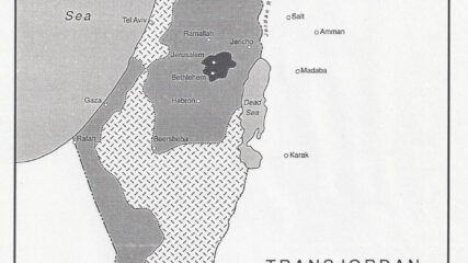
The Allon Plan, 1967

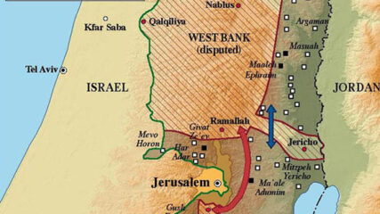
July 26, 1967: The Alon Plan reflects a response to Israel’s pre-1967 war border vulnerability seeking a future west bank arrangement that is not a strategic/geographic threat to Israel and its coastal plain population centers.

More Curated Essentials for Land

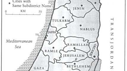
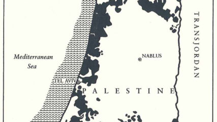
Land — Palestine and Israel in Maps

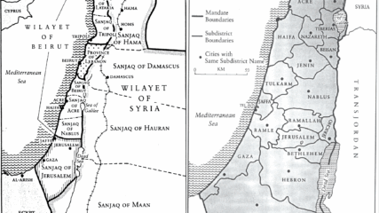
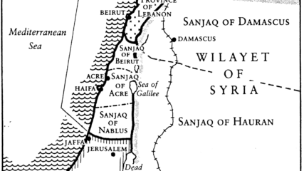
Map of Future Area of Palestine and Adjacent Areas, 1890s

The area of Eretz Yisrael was part of the Ottoman Empire and composed of three large administrative areas without any political identity as a state or part of a state. At times, portions of the area that was later designated as the Palestine Mandate were ruled from Mecca, Damascus, or Baghdad, or in the case of Jerusalem, directly from Istanbul.

Maps|1890s

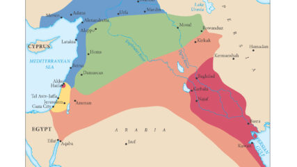
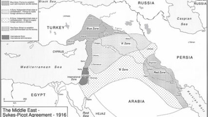
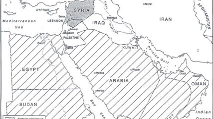
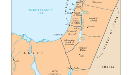
Map of Sykes-Picot Agreement, 1916

Great Britain and France secretly negotiated the Sykes-Picot Agreement in 1916. The two European powers agreed, according to their respective spheres of influence, to divide the Middle East territories previously administered by the Ottoman Empire.

Maps|May 16, 1916|Spanish

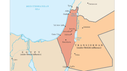
Map of the Separation of Transjordan, 1921

As shown in this map, the British in 1921 separated a new emirate, Transjordan, from what officially became the Mandate for Palestine the next year. The British officially maintained political and military control of both…

Palestine and Trans Jordan

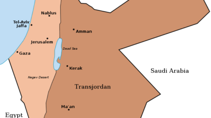
Map of Palestine and Transjordan, 1922

When Britain controlled Palestine, she lopped off 80% of it and assigned it to the Hashemite family leader, Emir Abdullah. It became today’s Hashemite Kingdom of Jordan.

Maps|1922

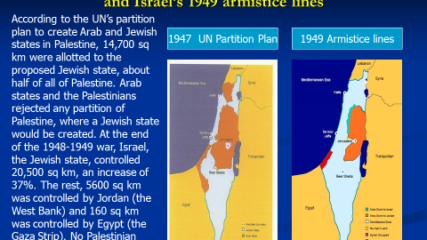
Map of U.N. Partition Plan, 1947

The United Nations General Assembly approved Resolution 181 on Nov. 29, 1947, to divide the British Mandate of Palestine into an Arab state and a Jewish state along the lines in this map, with an…

Maps|November 29, 1947|Spanish|German

Map of Israel’s 1949 Borders

This map shows the territories controlled by Israel, Jordan (including the West Bank(, Lebanon, Syria and Egypt (including the Gaza Strip) at the end of Israel’s War of Independence in 1949. An Arab state was…

Maps|February 24, 1949|Spanish

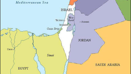
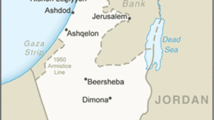
Map of Israel’s Armistice Lines, 1949-1967

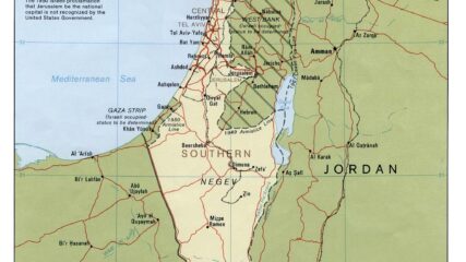
In the aftermath of the 1948 War of Independence, Israel signed armistice agreements with Egypt, Jordan, Syria, and Lebanon. These armistice lines lasted until the immediate aftermath of the June 1967 War. Israel has 1068 kilometers in land borders. Egypt 208 km, Gaza Strip 59 km, Jordan 307 km, Lebanon 81 km, Syria 83 km, and the West Bank 330 km; its Mediterranean coastline 273 km. CIA The World Factbook – Israel

Maps|1949-1967

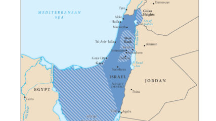
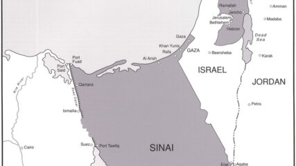
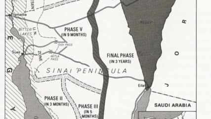
Map of Israel After the 1967 War

With its six-day victory in the June 1967 war, Israel added the Sinai Peninsula, the Gaza Strip, the Golan Heights and the West Bank (Judaea and Samaria) to the territory under its control. Israelis moved…

Maps|June 1967|Spanish

Allon Plan Map, 1967

Drafted by Minister of Labor Yigal Allon after the June 1967 war, the plan envisages Israeli retention of a series of settlements and military installations along the Jordan Valley as buffers to a potential Arab land attack from the east.

Maps|July 26, 1967

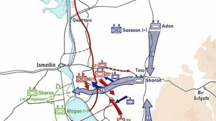
Map of Operation Gazelle, October 15-17, 1973

Israel troop crossings with Egyptian counterattacks during the Yom Kippur War (October 1973). Israeli forces were led by Generals Sharon, Aden and Magen. Description of the Israeli Suez Canal crossing, Israel State Archives, October War

Maps|October 15-17, 1973

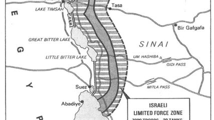
Map of Israeli-Egyptian Separation of Forces Agreement, January 1974

For Sadat, who had gone to war against Israel three months earlier, securing a military disengagement agreement was important. In addition, diplomatically engaging the US to secure the agreement meant entrenching Washington as a friend of Egypt. The US embraced the opportunity to quell tensions between Israel and Egypt, while squiring Cairo away from decades of Moscow’s embrace. Israel had its POWs returned and slowly tested Sadat’s broader intentions toward Jerusalem.

Maps|January 1974
Golan Heights after May 1974 Israeli Syrian Separation of Forces agreement

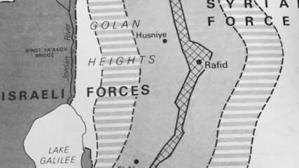
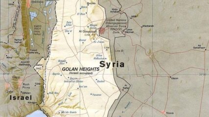
Map of Golan Heights After Israeli-Syrian Separation of Forces Agreement, May 1974

In the last days of the June 1967 War Israel secured a portion of the Syrian Golan Heights, estimated at 1300 sq km or 500 sq mi; Israel forces sit some 40 miles, 60km from Damascus. Before the June War, Israeli villages and populations in the valley were fired upon by Syrian forces from the Heights. In addition to being an important catchment for Jordan River waters which helps supply Israel’s water needs, the heights contain not fully explored hydrocarbon sources. In the northern Heights is Mt. Hermon which has strategic value for observing military movements into southern Lebanon and to Damascus.

Maps|May 1974
Jerusalem- Old City, 1988

Map of Jerusalem’s Old City, 1988

The Old City of Jerusalem is divided into four religious quarters: Armenian, Christian, Jewish and Muslim areas. The overall population of the Old City is 34,000, 11 percent of whom are Jews. Jews account for 59 percent of the population of the Old City’s Jewish Quarter and 49 percent of the Armenian Quarter.

Maps|1988
Jewish settlements in Gaza, August 2005

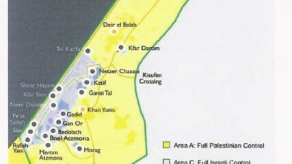
Map of Jewish Settlements in Gaza, August 2005

From 1977 to 1979, the settler population in the territories grew from 3,200 to 17,500, plus 80,000 in East Jerusalem. Of the 225,000 Israel settlers in the “territories” in 2005, all 8,500 settlers living in…

Maps|August 2005
Map of Jewish Settlements in the West Bank as of January 2005

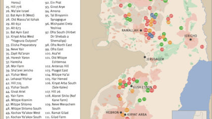
Map of Israeli West Bank Settlements, January 2005

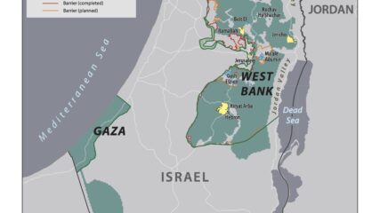
As an unintended consequence of the June 1967 War, Israel found itself controlling the entire West Bank of the Jordan River, amounting to 2,300 square miles with 680,000 Palestinian living in 396 villages, towns and…

Maps|January 2005

Maps of the Middle East and the Gaza Strip

Maps of the Gaza Strip, Israel’s villages and kibbutzim around the Gaza Strip, former Israeli settlements there, and Israel’s requested zone of civilian withdrawal 10.14.2023

Maps|October 19, 2023

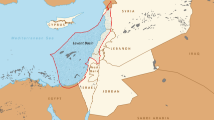
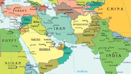
Middle East Map, 2025

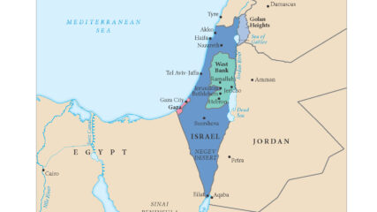
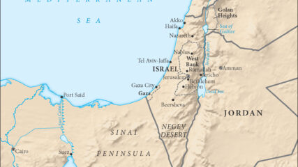
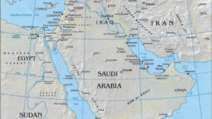
This 2018 map of the eastern Mediterranean, which remains current, shows all of Israel, Gaza, the West Bank, Lebanon and Cyprus, plus parts of Syria, Jordan, Egypt and Saudi Arabia, within the context of the…

Land to 1897

Diaspora to 1949 (2 videos, 56:36 and 31:15)

January 1949
Emory Professor of Contemporary and Middle Eastern History, Political Science, and Israeli Studies and Center for Israel Education President Ken Stein outlines the history of Zionism and the British Mandate at the CIE 2018 Educator Enrichment Workshop.

Era I: Jewish Peoplehood to 1897

July 5, 2023
From the biblical covenants, Jews bound themselves to the belief in one G-d, an unbreakable tie to the Land of Israel. From its inception, Jewish identity was wrapped around the mutual commitments between G-d and the people. Judaism became the foundation for Christianity and Islam.

Bibliography — Land

April 24, 2025
April 2025 Without equal, the most comprehensive portrayals and explanations of the land regime in the area of Palestine and Greater Syria during Ottoman times can be found in a dozen or so scholarly works...

1898 to 1948

Explainer: The Economy of the Yishuv and the State of Israel

March 24, 2025
By Ken Stein and Scott Abramson, March 23, 2025 Zionist/Jewish Economic Development in Palestine Before 1948 Jewish physical growth in Mandatory Palestine in the period known as the New Yishuv was sufficient through land acquired...

Zionists and Arabs: Historical Sources on the Path to the Modern State of Israel

June 13, 2021
Compiled by Dr. Ken Stein, June 2021 These sources and references unfold the history of the Jewish state through 1949, from state-seeking to state-making to state-keeping.

Era II: Zionism to Israel, 1898 to 1948

July 5, 2023
From 1898 to 1948, Zionism evolved from an idea to a concrete reality: the actual establishment of the Jewish state, Israel. Slowly, a few immigrating Jews created facts by linking people to the land. For half a century, fortuity and fortitude made the Zionist undertaking a reality. They exhibited pragmatism and gradually constructed a nucleus for a state. Through perseverance Zionists empowered themselves.

Systematic Agricultural Colonization in Palestine

August 21, 1933
August 21, 1933 J. Elazari – Volcani (Issac Vilkanski) SYSTEMATIC AGRICULTURAL COLONIZATION IN PALESTINE REPORT PRESENTED AT THE XVIIITH ZIONIST CONGRESS PRAGUE, 1933 Special Printing from the Protocol of the XVIIIth Zionist Congress 1934 Published...

Balfour Declaration, 1917

November 2, 1917
British Foreign Ministry promises to set up a Jewish National Home in Palestine with no harm to non-Jewish populations, or to Jews living elsewhere who might want to support a Jewish home.

San Remo Conference Agreement, 1920: Borders Set for Postwar Middle Eastern Mandates

April 25, 1920
April 25, 1920 In April 1920, the San Remo Conference in Italy determined the boundaries of the territories captured by the allies during World War I. These included boundaries for the political existence of Syria,...

Zirin Village Land Sales

August 16, 1930
The sale of Zirin Village to the Jewish National Fund was collusively undertaken by a local Arab family through the British Courts in Palestine. The process intentionally avoided financial compensation to the resident Arab occupants.

Jewish Agency’s Margalith Identifies Arab Peasant Displacement From Arab Landlord Sales to Jewish Buyers, 1930

February 5, 1930
Two letters detail how Arab peasants are sometimes swindled out of their lands by Arab land brokers and effendis, noting economic harm to them, and how they learn to avoid landlords and sell directly to Jewish buyers. Intra-Arab communal tension rises.

Rural Change and Peasant Destitution: Contributing Causes to the Arab Revolt in Palestine, 1936-1939

1989
Kenneth Stein, “Rural Change and Peasant Destitution: Contributing Causes to the Arab Revolt in Palestine, 1936-1939,” John Waterbury and Farhad Kazemi (eds.), Peasants and Politics in the Modern Middle East, Florida International University Press (1989), pp. 143-170....

Political Significance of JNF Land Purchase, 1937

December 31, 1937
With more Arab sale offers than funds for purchases, Zionist leaders decide on strategic priorities and designate areas around Haifa, Jerusalem-Jaffa road, and the Galilee near headwaters of the Jordan River.

1931-1949: Arab Land Sales to Jews — Palestine Arab Press, British Reports and Zionist Accounts

1931-1949
These Palestinian Arab newspaper materials and other quotations about Arab land sales to the Zionists during the British Mandate were first read and collected at the National Library at the Hebrew University on the Givat...

HMG White Paper: Statement of Policy, 1939

May 23, 1939
Zionist leaders—David Ben-Gurion, Chaim Weizmann and Eliezer Kaplan—learning of the British intent to limit severely the Jewish national home’s growth. Increasingly, they are also aware of the German government’s hostilities towards European Jewry.

Palestine’s Rural Economy, 1917-1939

January 29, 2025
Kenneth Stein, “Palestine’s Rural Economy, 1917-1939,” Studies in Zionism, Vol. 8, No. 1 (1987), pp. 25-49. During the early decades of the 20th century in Palestine, the majority Arab population sustained itself primarily through agricultural and pastoral...

Ken Stein: “Zionist Land Acquisition: A Core Element in Establishing Israel”

June 2020
Kenneth W. Stein, “Zionist Land Acquisition: a core element in establishing Israel,” in Michael J. Cohen, (ed.) The British Mandate in Palestine: A Centenary Volume, 1920-2020, Routledge, 2020, pp. 189-204.

Jewish National Fund — Minutes of a Meeting of Those Involved in Purchasing Lands, November 1946

November 10, 1946
The JNF estimated that up to 250,000 dunams (a dunam was a quarter of an acre) could be purchased if funds were available despite Arab opposition to sales and a steep rise in prices. By then, Jews owned 1.6 million dunams of land, with more than half of Palestine not owned by anyone.

Composite Statements in KKL/JNF Discussions About Lands to Purchase, 1926-1948

January 22, 2025
Dr. Kenneth Stein, Professor Emeritus, Emory University, kenstein@israeled.org, November 2024 Sources: Minutes of JNF meetings, statements by JNF officials, comments in the Palestinian Arab Press, remarks by British Colonial officials, and official reports. All KKL...

Zionist Leaders Debate Land Purchase Strategies

February 19, 1936
Zionist leaders debate how to confront proposed British restrictions on Jewish land purchase in Palestine.

Israel in Context: How did the Zionists Make the State: 1882-1949? Professor Ken Stein (48:32)

June 28, 2020
Using archival and published sources, including materials from the CIE website, CIE President Ken Stein identifies six factors as reasons for the Zionists’ success: Zionist political action, the impaired socio-economic condition of the Arab population,...

Ken Stein: Socio-Economic Differences Preface Palestine’s Political Partition — The Mandate

1932
Primary sources, reputable scholarship and archival materials collectively show major communal (Arab-Jewish) socio-economic separation, factors that foreshadowed geo-spatial partition.

Britain in 1939 Reaffirms Area of Palestine Was Not Promised to Sharif of Mecca During World War I

March 16, 1939
March 16, 1939 Was the area of Palestine excluded from British promises made to Sharif Hussein of Mecca during World War I? A British investigation in 1939 said it was not part of a British...

British White Paper Restricts Jewish Immigration and Land Purchase

May 17, 1939
The 1939 White Paper signaled Britain’s readiness to relegate the Jews in Palestine to minority status in a future majority-Arab state.

A Zionist State in 1939

January 19, 2002
“A Zionist State in 1939,” Dr. Kenneth W. Stein, CHAI (Atlanta), Winter 2002 “Had not the Nazi crimes been committed against Jews during World War II, the Jewish State would have never come true.” So...

Land Transfer Inquiry Committee Report, 1945

November 1945
Circumventing the existing law on prohibition of land sales to Jews, Palestinian Arabs are found selling lands regularly and furtively to Zionists.

UNGA Resolution 181

November 29, 1947
The 1937 plan to partition Palestine was never implemented. It did, however, remain a workable political option for resolving the conflict between Arabs and Zionists. Britain needed to placate Arab state opposition to Zionism, so it refrained from actively revisiting the partition plan.

Ken Stein, “One Hundred Years of Social Change: The Creation of the Palestinian Refugee Problem”

1991
Kenneth W. Stein, “One Hundred Years of Social Change: The Creation of the Palestinian Refugee Problem,” in Laurence Silberstein (ed.), New Perspectives on Israeli History: The Early Years of the State, New York University Press,...

Ken Stein, “Legal Protection and Circumvention of Rights for Cultivators in Mandatory Palestine”

April 7, 2025
Stein, Kenneth, “Legal Protection and Circumvention of Rights for Cultivators in Mandatory Palestine,” in Joel S. Migdal, (Ed.) Palestinian Society and Politics, Princeton, (1980): 233-260. In the immediate wake of communal violence that plagued Palestine...

1948 to 1982

Israeli Government-Designed Peace Plan After June 1967 War

June 19, 1967
Following the conclusion of the June 1967 War, the Israeli government sent word to Egypt and Syria seeking peace plan that was intended to jumpstart a peace process with Israel’s belligerent neighbors, Egypt and Syria. The messages were sent through the US, but no response was apparently received.

U.N. Security Council Resolution 242, 1967

November 22, 1967
The Resolution calls for unspecified Israel withdrawal from territories in return for right of all states to live in peace. It does not call for full withdrawal. It is the basis of Egyptian (1979) and Jordanian (1994) Treaties with Israel, and PLO (1993) recognition of Israel.

The “Galili Plan”

August 1973
With less than three dozen Israeli settlements in the territories taken in the June War, the proposal is not for a vast settlement increase, but for economic, infrastructure, and industrial development of the areas.

Israeli Prime Minister Menachem Begin’s Palestinian Autonomy Plan, 1977

December 28, 1977
Five weeks after Egyptian President Anwar Sadat flew to Jerusalem in November 1977, to accelerate Egyptian – Israeli negotiations, Begin brought to President Jimmy Carter, Israel’s response to Sadat’s peace initiative: political autonomy for the Palestinians in the West Bank and Gaza Strip. No Palestinian state was considered.

President Carter’s Meeting With Israeli Foreign Minister Dayan, September 1977

September 19, 1977
The vast gulf in US and Israeli positions about Palestinian self-determination, the degree of withdrawal from the West Bank, and future borders is precisely stated. A year later at the end of the Camp David negotiations, Israeli and US views had not changed at all.

Egyptian President Sadat’s Knesset Address, November 1977

November 20, 1977
Sadat tells the Israeli people and world that he seeks a just and durable peace, which is not a separate peace, between Israel and Egypt. He equates statehood for the Palestinians as their right to return.

U.N. Security Council Resolution 446: Territories Occupied by Israel, 1979

March 22, 1979
Carefully sandwiched between Carter’s high-risk presidential visit to Egypt and Israel on March 10, 1979—to solve contentious disagreements between Sadat and Begin—and the Peace Treaty signing on March 26, 1979, his administration gladly votes at the UN to deplore Israeli settlement building; including demographic changes in Jerusalem. After the Peace Treaty signing, until it leaves office in 1981, the Carter administration will continue to barrage Israel with condemnation for settlement building.

U.N. Security Council Resolution 452, 1979

July 20, 1979
This was the second UNSC Resolution within four months supported by the Carter administration condemning Israel's settlement building in the territories. It too greatly angered the Israeli government and American supporters of Israel.

U.N. Security Council Resolution 465 on Jerusalem, Settlements and Territories, 1980

March 1, 1980
Showing its public opposition to Israeli actions in the lands taken in the June 1967 war, an area that the Carter Administration wanted reserved for Palestinian self-rule, it 'strongly deplores' Israel's settlement policies. Passage of the resolution three weeks prior to the New York and Connecticut presidential primaries, cause many Jewish voters to vote in favor of Ted Kennedy and not for Carter, helping to splinter the Democratic Party.

U.N. Security Council Resolution 478 on Territories Taken in June 1967, Enacted 1980

August 20, 1980
The United States abstains on a Security Council resolution declaring Israel's Basic Law on Jerusalem to be in violation of international law.

1983 to Present

Jordanian King Hussein on the Hashemite Kingdom’s Separation From West Bank

July 28, 1988
Jordan's King Hussein made a strategic decision to disassociate administratively from the West Bank, leaving it to focus Jordanian national identity on only the east bank of the Jordan River. The PLO subsequently negotiated with Israel to rule over some of these lands, as codified in the 1993 Oslo Accords, but no Palestinian state was promised.

Prime Minister Ariel Sharon’s Address at the Fourth Herzliya Conference, 2003

December 18, 2003
In his speech at the annual Herziliya Conference, PM Sharon articulates his view that the Quartet’s 2003 Road Map for Peace “is the only political plan accepted by Israel, the Palestinians, the Americans and a majority of the international community. We are willing to proceed toward its implementation: two states Israel and a Palestinian State living side by side in tranquility, security and peace.”

Israeli Prime Minister Ariel Sharon’s Address at the Herzliya Conference, 2004

December 16, 2004
Prime Minister Sharon unilaterally withdrew Israeli military and civilian forces from the Gaza Strip in August 2005. Sharon sought to ensure Israel’s Jewish and democratic essence by getting out of the lives of the Palestinians. Instead Hamas used the territory to kill Jews and degrade Israel morally. Two decades later what would Sharon have said about trusting your neighbor unilaterally?

U.N. Security Council Resolution 1701: Israel-Lebanon Border, 2006

August 11, 2006
Adopted in August 2006, this UN Resolution brought the 33 day Israel-Hezbollah war to an end, but it conspicuously failed to bring the Israel-Hezbollah conflict to conclusion. Though intended, keeping Hezbollah fighters from reoccupying the Israel-Lebanese border areas was not halted, giving rise to semi continuous cross the border firings, leading to its intensification after October 2023, with Hamas attack on Israel.

European Parliament Calls for Recognition of Palestinian Statehood in Context of 2 States Side by Side

December 17, 2014
European Parliament calls for recognition of Palestinian statehood in the context for a negotiated two-state solution for Palestinians and Israelis; it outlines the political and geographic contours for a negotiated outcome.

Sovereign Israeli Rights

March 3, 2017
Placing Jewish destiny into Jewish hands was why Zionism emerged at the end of the 19th century. Acquiring political power to promote Jewish security is how a Jewish state was created.

President Trump’s Speech Recognizing Jerusalem as the Capital of Israel, 2017

December 6, 2017
President Trump’s proclamation to “officially recognize Jerusalem as the capital of Israel” breaks precedent. In doing so, he incurs bipartisan support in the US congress, but a flurry of criticism from analysts, diplomats and foreign leaders. In his remarks, Trump rebukes claims that he disqualified the US as a “reliable mediator” in future Palestinian-Israeli negotiations.

Are They Legal or Not? Pompeo’s Announcement on the Israeli Settlements

November 24, 2019
The announcement by US Secretary of State Mike Pompeo that "the establishment of Israeli civilian settlements in the West Bank is not, per se, inconsistent with international law" is in line with Israel's official position, and its inherent message - that preoccupation with the question of the legality of the settlements narrows Palestinian flexibility and discourages the achievement of a negotiated resolution to the conflict - is correct. However, the announcement’s practical value is minor, and there are even potential risks and costs for Israel.

What Do Israelis Think About the Golan Heights?

March 31, 2019
On March 25th 2019, President Trump signed an order for the United States’ official recognition of Israeli sovereignty over the Golan Heights. This article surveys Israeli public opinion regarding this issue, and its reactions to this announcement. Surveys have shown a consistently high level of support among Jewish Israelis for keeping the Golan Heights, and while there is some disagreement - Jews across the political spectrum support President Trump’s decision.

Presidential Proclamation Recognizing Golan Heights as Part of Israel, 2019

March 25, 2019
U.S. President Donald Trump recognizes Israeli sovereignty over the Golan Heights more than 37 years after Israel annexed the mountains.

Trump Peace Plan Map Showing Settlements and Solutions, 2020

January 28, 2020
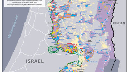
This map shows the State of Palestine as proposed by the Trump plan with features and selected locations from the Washington Institute Settlements and Solutions website.